You are here: Home > Network List > TA - USArray Transportable Network (new EarthScope stations) Stations List
> Station D25K Kavik River, AK, USA > Earthquake Result Viewer
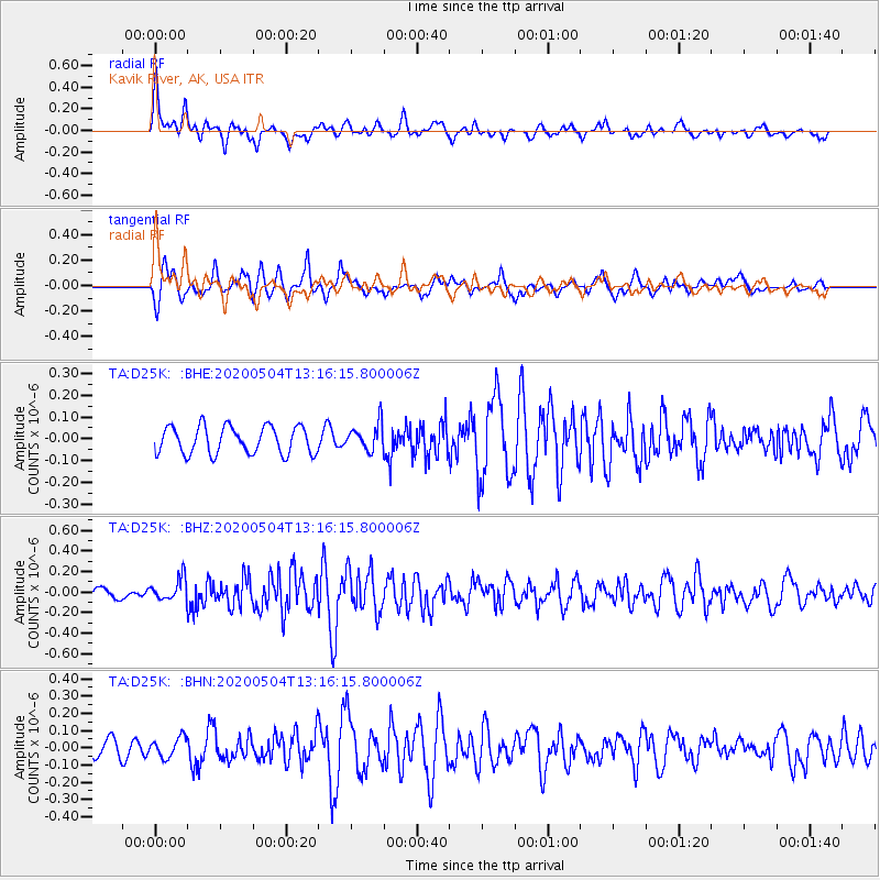
D25K Kavik River, AK, USA - Earthquake Result Viewer
*The percent match for this event was below the threshold and hence no stack was calculated.
| Earthquake location: |
Near East Coast Of Honshu, Japan |
| Earthquake latitude/longitude: |
35.7/140.9 |
| Earthquake time(UTC): |
2020/05/04 (125) 13:07:48 GMT |
| Earthquake Depth: |
41 km |
| Earthquake Magnitude: |
5.6 Mww |
| Earthquake Catalog/Contributor: |
NEIC PDE/us |
|
| Network: |
TA USArray Transportable Network (new EarthScope stations) |
| Station: |
D25K Kavik River, AK, USA |
| Lat/Lon: |
69.32 N/146.38 W |
| Elevation: |
770 m |
|
| Distance: |
51.1 deg |
| Az: |
25.857 deg |
| Baz: |
268.549 deg |
| Ray Param: |
$rayparam |
*The percent match for this event was below the threshold and hence was not used in the summary stack. |
|
| Radial Match: |
70.90638 % |
| Radial Bump: |
400 |
| Transverse Match: |
75.11818 % |
| Transverse Bump: |
400 |
| SOD ConfigId: |
21166931 |
| Insert Time: |
2020-05-18 13:23:32.378 +0000 |
| GWidth: |
2.5 |
| Max Bumps: |
400 |
| Tol: |
0.001 |
|
Signal To Noise
| Channel | StoN | STA | LTA |
| TA:D25K: :BHZ:20200504T13:16:15.800006Z | 2.5450044 | 1.1071865E-7 | 4.3504308E-8 |
| TA:D25K: :BHN:20200504T13:16:15.800006Z | 1.0287179 | 5.6419392E-8 | 5.4844378E-8 |
| TA:D25K: :BHE:20200504T13:16:15.800006Z | 0.96812224 | 6.097055E-8 | 6.2978145E-8 |
| Arrivals |
| Ps | |
| PpPs | |
| PsPs/PpSs | |


