You are here: Home > Network List > TA - USArray Transportable Network (new EarthScope stations) Stations List
> Station G31M Satah River, YT, CAN > Earthquake Result Viewer
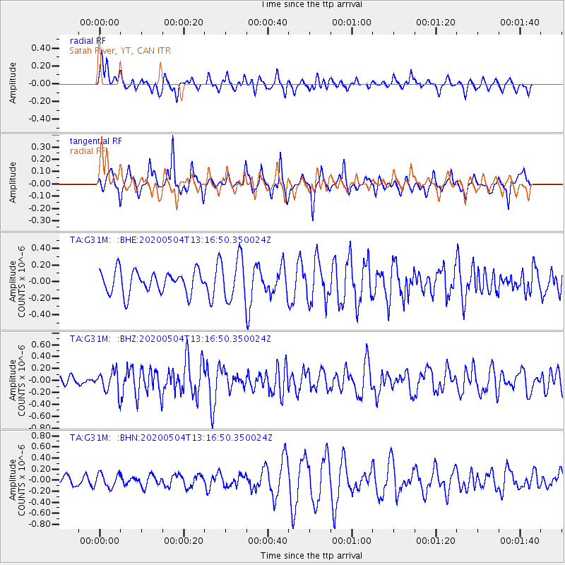
G31M Satah River, YT, CAN - Earthquake Result Viewer
*The percent match for this event was below the threshold and hence no stack was calculated.
| Earthquake location: |
Near East Coast Of Honshu, Japan |
| Earthquake latitude/longitude: |
35.7/140.9 |
| Earthquake time(UTC): |
2020/05/04 (125) 13:07:48 GMT |
| Earthquake Depth: |
41 km |
| Earthquake Magnitude: |
5.6 Mww |
| Earthquake Catalog/Contributor: |
NEIC PDE/us |
|
| Network: |
TA USArray Transportable Network (new EarthScope stations) |
| Station: |
G31M Satah River, YT, CAN |
| Lat/Lon: |
66.92 N/134.27 W |
| Elevation: |
61 m |
|
| Distance: |
55.8 deg |
| Az: |
28.35 deg |
| Baz: |
281.266 deg |
| Ray Param: |
$rayparam |
*The percent match for this event was below the threshold and hence was not used in the summary stack. |
|
| Radial Match: |
38.660084 % |
| Radial Bump: |
334 |
| Transverse Match: |
49.0109 % |
| Transverse Bump: |
285 |
| SOD ConfigId: |
21166931 |
| Insert Time: |
2020-05-18 13:23:49.942 +0000 |
| GWidth: |
2.5 |
| Max Bumps: |
400 |
| Tol: |
0.001 |
|
Signal To Noise
| Channel | StoN | STA | LTA |
| TA:G31M: :BHZ:20200504T13:16:50.350024Z | 1.5704888 | 1.8069267E-7 | 1.1505505E-7 |
| TA:G31M: :BHN:20200504T13:16:50.350024Z | 0.8845796 | 1.2419636E-7 | 1.4040157E-7 |
| TA:G31M: :BHE:20200504T13:16:50.350024Z | 1.9183336 | 2.5530616E-7 | 1.3308745E-7 |
| Arrivals |
| Ps | |
| PpPs | |
| PsPs/PpSs | |


