EKS2 KN.EKS2 - Earthquake Result Viewer
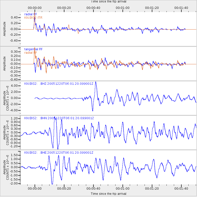
Earthquake location: W. Caroline Islands, Micronesia
Earthquake latitude/longitude: 12.2/141.0
Earthquake time(UTC): 2005/12/20 (354) 05:51:12 GMT
Earthquake Depth: 23 km
Earthquake Magnitude: 5.8 MB, 5.7 MS, 6.1 MW, 6.1 MW
Earthquake Catalog/Contributor: WHDF/NEIC
Network: KN Kyrgyz Seismic Telemetry Network
Station: EKS2 KN.EKS2
Lat/Lon: 42.66 N/73.78 E
Elevation: 1360 m
Distance: 65.1 deg
Az: 311.417 deg
Baz: 96.351 deg
Ray Param: 0.058479585
Estimated Moho Depth: 50.5 km
Estimated Crust Vp/Vs: 1.79
Assumed Crust Vp: 6.316 km/s
Estimated Crust Vs: 3.523 km/s
Estimated Crust Poisson's Ratio: 0.27
Radial Match: 94.02192 %
Radial Bump: 400
Transverse Match: 84.75133 %
Transverse Bump: 400
SOD ConfigId: 2422
Insert Time: 2010-03-08 19:50:52.887 +0000
GWidth: 2.5
Max Bumps: 400
Tol: 0.001

Signal To Noise

ChannelStoNSTALTA
KN:EKS2: :BHN:20051220T06:01:20.099001Z0.51372125.222859E-81.0166718E-7
KN:EKS2: :BHE:20051220T06:01:20.099001Z1.06400817.9559015E-87.477295E-8
KN:EKS2: :BHZ:20051220T06:01:20.099001Z1.92488412.2804993E-71.1847463E-7
Arrivals
Ps6.6 SECOND
PpPs21 SECOND
PsPs/PpSs28 SECOND