You are here: Home > Network List > CN - Canadian National Seismograph Network Stations List
> Station INK INUVIK, NT > Earthquake Result Viewer
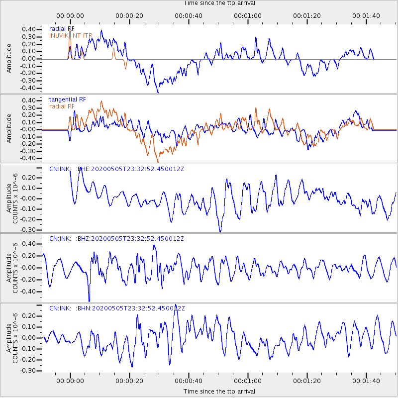
INK INUVIK, NT - Earthquake Result Viewer
*The percent match for this event was below the threshold and hence no stack was calculated.
| Earthquake location: |
Samoa Islands |
| Earthquake latitude/longitude: |
-14.7/-172.4 |
| Earthquake time(UTC): |
2020/05/05 (126) 23:20:40 GMT |
| Earthquake Depth: |
33 km |
| Earthquake Magnitude: |
5.6 Mi |
| Earthquake Catalog/Contributor: |
NEIC PDE/pt |
|
| Network: |
CN Canadian National Seismograph Network |
| Station: |
INK INUVIK, NT |
| Lat/Lon: |
68.31 N/133.53 W |
| Elevation: |
44 m |
|
| Distance: |
87.4 deg |
| Az: |
13.512 deg |
| Baz: |
217.456 deg |
| Ray Param: |
$rayparam |
*The percent match for this event was below the threshold and hence was not used in the summary stack. |
|
| Radial Match: |
57.8247 % |
| Radial Bump: |
400 |
| Transverse Match: |
50.460148 % |
| Transverse Bump: |
400 |
| SOD ConfigId: |
21166931 |
| Insert Time: |
2020-05-19 23:26:48.898 +0000 |
| GWidth: |
2.5 |
| Max Bumps: |
400 |
| Tol: |
0.001 |
|
Signal To Noise
| Channel | StoN | STA | LTA |
| CN:INK: :BHZ:20200505T23:32:52.450012Z | 0.6934432 | 7.617991E-8 | 1.0985747E-7 |
| CN:INK: :BHN:20200505T23:32:52.450012Z | 0.6942622 | 8.746624E-8 | 1.2598446E-7 |
| CN:INK: :BHE:20200505T23:32:52.450012Z | 1.6678561 | 1.4417289E-7 | 8.6442036E-8 |
| Arrivals |
| Ps | |
| PpPs | |
| PsPs/PpSs | |


