You are here: Home > Network List > US - United States National Seismic Network Stations List
> Station MSO Missoula, Montana, USA > Earthquake Result Viewer
MSO Missoula, Montana, USA - Earthquake Result Viewer
*The percent match for this event was below the threshold and hence no stack was calculated.
| Earthquake location: |
Samoa Islands |
| Earthquake latitude/longitude: |
-14.7/-172.4 |
| Earthquake time(UTC): |
2020/05/05 (126) 23:20:40 GMT |
| Earthquake Depth: |
33 km |
| Earthquake Magnitude: |
5.6 Mi |
| Earthquake Catalog/Contributor: |
NEIC PDE/pt |
|
| Network: |
US United States National Seismic Network |
| Station: |
MSO Missoula, Montana, USA |
| Lat/Lon: |
46.83 N/113.94 W |
| Elevation: |
1264 m |
|
| Distance: |
80.6 deg |
| Az: |
36.392 deg |
| Baz: |
236.74 deg |
| Ray Param: |
$rayparam |
*The percent match for this event was below the threshold and hence was not used in the summary stack. |
|
| Radial Match: |
48.346268 % |
| Radial Bump: |
400 |
| Transverse Match: |
62.596657 % |
| Transverse Bump: |
400 |
| SOD ConfigId: |
21166931 |
| Insert Time: |
2020-05-19 23:35:31.891 +0000 |
| GWidth: |
2.5 |
| Max Bumps: |
400 |
| Tol: |
0.001 |
|
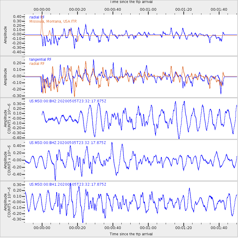
Signal To Noise
| Channel | StoN | STA | LTA |
| US:MSO:00:BHZ:20200505T23:32:17.875Z | 1.501542 | 1.6078867E-7 | 1.0708238E-7 |
| US:MSO:00:BH1:20200505T23:32:17.875Z | 0.89642966 | 1.281851E-7 | 1.4299516E-7 |
| US:MSO:00:BH2:20200505T23:32:17.875Z | 2.9934974 | 2.3969557E-7 | 8.0072084E-8 |
| Arrivals |
| Ps | |
| PpPs | |
| PsPs/PpSs | |


