EKS2 KN.EKS2 - Earthquake Result Viewer
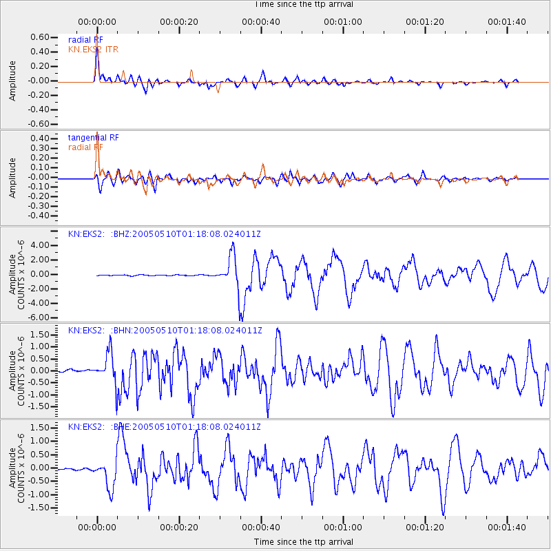
Earthquake location: Southwest Of Sumatra, Indonesia
Earthquake latitude/longitude: -6.2/103.1
Earthquake time(UTC): 2005/05/10 (130) 01:09:05 GMT
Earthquake Depth: 17 km
Earthquake Magnitude: 5.9 MB, 6.4 MS, 6.2 MW, 6.2 MW
Earthquake Catalog/Contributor: WHDF/NEIC
Network: KN Kyrgyz Seismic Telemetry Network
Station: EKS2 KN.EKS2
Lat/Lon: 42.66 N/73.78 E
Elevation: 1360 m
Distance: 55.5 deg
Az: 333.969 deg
Baz: 143.737 deg
Ray Param: 0.064735636
Estimated Moho Depth: 25.25 km
Estimated Crust Vp/Vs: 1.75
Assumed Crust Vp: 6.316 km/s
Estimated Crust Vs: 3.599 km/s
Estimated Crust Poisson's Ratio: 0.26
Radial Match: 92.71808 %
Radial Bump: 400
Transverse Match: 88.083496 %
Transverse Bump: 400
SOD ConfigId: 2455
Insert Time: 2010-03-08 19:51:51.176 +0000
GWidth: 2.5
Max Bumps: 400
Tol: 0.001

Signal To Noise

ChannelStoNSTALTA
KN:EKS2: :BHN:20050510T01:18:08.024011Z16.9993046.8143106E-74.0085823E-8
KN:EKS2: :BHE:20050510T01:18:08.024011Z12.7509475.556221E-74.3574968E-8
KN:EKS2: :BHZ:20050510T01:18:08.024011Z47.170272.4086557E-65.1063004E-8
Arrivals
Ps3.2 SECOND
PpPs10 SECOND
PsPs/PpSs14 SECOND