EKS2 KN.EKS2 - Earthquake Result Viewer
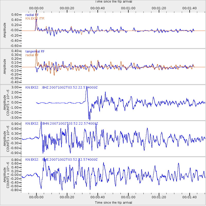
Earthquake location: Southern Sumatra, Indonesia
Earthquake latitude/longitude: -4.2/101.2
Earthquake time(UTC): 2007/10/02 (275) 03:43:40 GMT
Earthquake Depth: 32 km
Earthquake Magnitude: 5.7 MB, 5.9 MS, 5.9 MW, 5.8 MW
Earthquake Catalog/Contributor: WHDF/NEIC
Network: KN Kyrgyz Seismic Telemetry Network
Station: EKS2 KN.EKS2
Lat/Lon: 42.66 N/73.78 E
Elevation: 1360 m
Distance: 52.9 deg
Az: 334.769 deg
Baz: 144.807 deg
Ray Param: 0.06640604
Estimated Moho Depth: 18.25 km
Estimated Crust Vp/Vs: 2.09
Assumed Crust Vp: 6.316 km/s
Estimated Crust Vs: 3.029 km/s
Estimated Crust Poisson's Ratio: 0.35
Radial Match: 92.20997 %
Radial Bump: 400
Transverse Match: 74.98762 %
Transverse Bump: 400
SOD ConfigId: 2564
Insert Time: 2010-03-08 19:52:26.302 +0000
GWidth: 2.5
Max Bumps: 400
Tol: 0.001

Signal To Noise

ChannelStoNSTALTA
KN:EKS2: :BHN:20071002T03:52:22.574009Z8.0170734.4966458E-75.608837E-8
KN:EKS2: :BHE:20071002T03:52:22.574009Z7.54661132.9012529E-73.8444448E-8
KN:EKS2: :BHZ:20071002T03:52:22.574009Z26.6080651.5251094E-65.7317564E-8
Arrivals
Ps3.3 SECOND
PpPs8.5 SECOND
PsPs/PpSs12 SECOND