
EKS2 KN.EKS2 - Earthquake Result Viewer
| ||||||||||||||||||
| ||||||||||||||||||
| ||||||||||||||||||
|
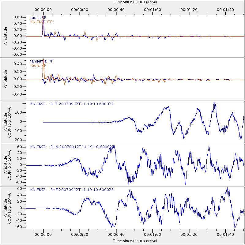
Signal To Noise
| Channel | StoN | STA | LTA |
| KN:EKS2: :BHN:20070912T11:19:10.60002Z | 5.5288324 | 9.939426E-7 | 1.7977442E-7 |
| KN:EKS2: :BHE:20070912T11:19:10.60002Z | 4.2998996 | 6.835372E-7 | 1.5896585E-7 |
| KN:EKS2: :BHZ:20070912T11:19:10.60002Z | 4.977167 | 1.8209033E-6 | 3.6585135E-7 |
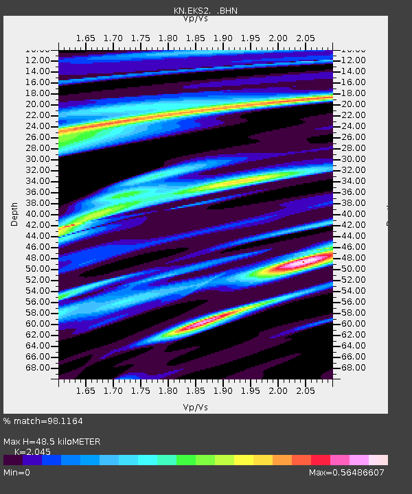
| Arrivals | |
| Ps | 8.4 SECOND |
| PpPs | 22 SECOND |
| PsPs/PpSs | 31 SECOND |

