You are here: Home > Network List > TA - USArray Transportable Network (new EarthScope stations) Stations List
> Station D23K Nanushuk River, AK USA > Earthquake Result Viewer
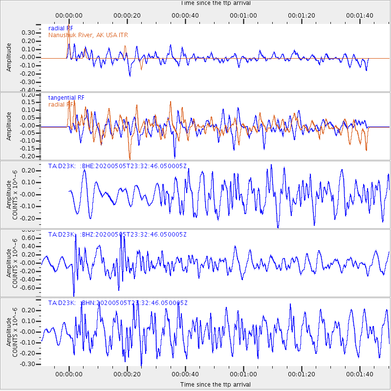
D23K Nanushuk River, AK USA - Earthquake Result Viewer
*The percent match for this event was below the threshold and hence no stack was calculated.
| Earthquake location: |
Samoa Islands Region |
| Earthquake latitude/longitude: |
-15.2/-172.9 |
| Earthquake time(UTC): |
2020/05/05 (126) 23:20:40 GMT |
| Earthquake Depth: |
10 km |
| Earthquake Magnitude: |
5.5 mb |
| Earthquake Catalog/Contributor: |
NEIC PDE/us |
|
| Network: |
TA USArray Transportable Network (new EarthScope stations) |
| Station: |
D23K Nanushuk River, AK USA |
| Lat/Lon: |
68.97 N/150.68 W |
| Elevation: |
406 m |
|
| Distance: |
85.4 deg |
| Az: |
7.884 deg |
| Baz: |
201.522 deg |
| Ray Param: |
$rayparam |
*The percent match for this event was below the threshold and hence was not used in the summary stack. |
|
| Radial Match: |
50.48477 % |
| Radial Bump: |
400 |
| Transverse Match: |
61.751522 % |
| Transverse Bump: |
400 |
| SOD ConfigId: |
21166931 |
| Insert Time: |
2020-05-19 23:49:43.087 +0000 |
| GWidth: |
2.5 |
| Max Bumps: |
400 |
| Tol: |
0.001 |
|
Signal To Noise
| Channel | StoN | STA | LTA |
| TA:D23K: :BHZ:20200505T23:32:46.050005Z | 2.116577 | 2.9022016E-7 | 1.371177E-7 |
| TA:D23K: :BHN:20200505T23:32:46.050005Z | 2.4972074 | 1.0208374E-7 | 4.087916E-8 |
| TA:D23K: :BHE:20200505T23:32:46.050005Z | 0.7947783 | 6.613912E-8 | 8.321707E-8 |
| Arrivals |
| Ps | |
| PpPs | |
| PsPs/PpSs | |


