You are here: Home > Network List > TA - USArray Transportable Network (new EarthScope stations) Stations List
> Station I17K Unalakleet, AK, USA > Earthquake Result Viewer
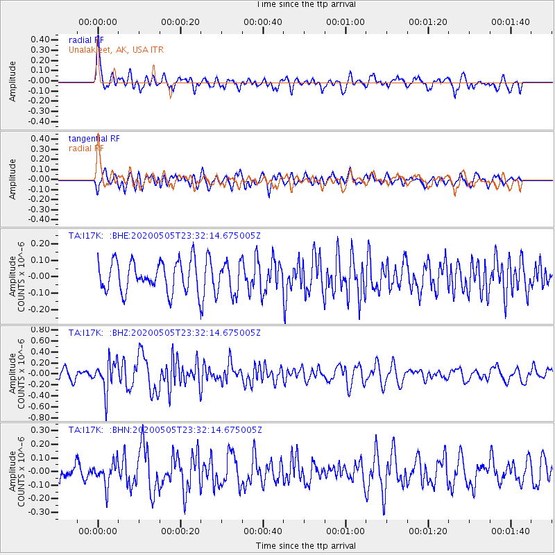
I17K Unalakleet, AK, USA - Earthquake Result Viewer
*The percent match for this event was below the threshold and hence no stack was calculated.
| Earthquake location: |
Samoa Islands Region |
| Earthquake latitude/longitude: |
-15.2/-172.9 |
| Earthquake time(UTC): |
2020/05/05 (126) 23:20:40 GMT |
| Earthquake Depth: |
10 km |
| Earthquake Magnitude: |
5.5 mb |
| Earthquake Catalog/Contributor: |
NEIC PDE/us |
|
| Network: |
TA USArray Transportable Network (new EarthScope stations) |
| Station: |
I17K Unalakleet, AK, USA |
| Lat/Lon: |
63.89 N/160.70 W |
| Elevation: |
105 m |
|
| Distance: |
79.4 deg |
| Az: |
5.477 deg |
| Baz: |
192.021 deg |
| Ray Param: |
$rayparam |
*The percent match for this event was below the threshold and hence was not used in the summary stack. |
|
| Radial Match: |
71.89086 % |
| Radial Bump: |
400 |
| Transverse Match: |
58.545895 % |
| Transverse Bump: |
400 |
| SOD ConfigId: |
21166931 |
| Insert Time: |
2020-05-19 23:50:44.673 +0000 |
| GWidth: |
2.5 |
| Max Bumps: |
400 |
| Tol: |
0.001 |
|
Signal To Noise
| Channel | StoN | STA | LTA |
| TA:I17K: :BHZ:20200505T23:32:14.675005Z | 3.0228157 | 2.8316074E-7 | 9.3674494E-8 |
| TA:I17K: :BHN:20200505T23:32:14.675005Z | 1.1715008 | 8.8703075E-8 | 7.5717466E-8 |
| TA:I17K: :BHE:20200505T23:32:14.675005Z | 1.0236272 | 9.3000985E-8 | 9.085435E-8 |
| Arrivals |
| Ps | |
| PpPs | |
| PsPs/PpSs | |


