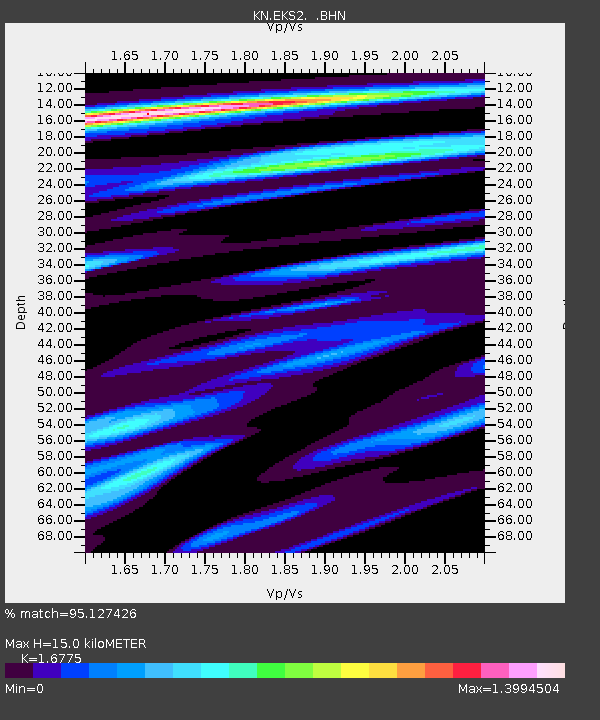
EKS2 KN.EKS2 - Earthquake Result Viewer
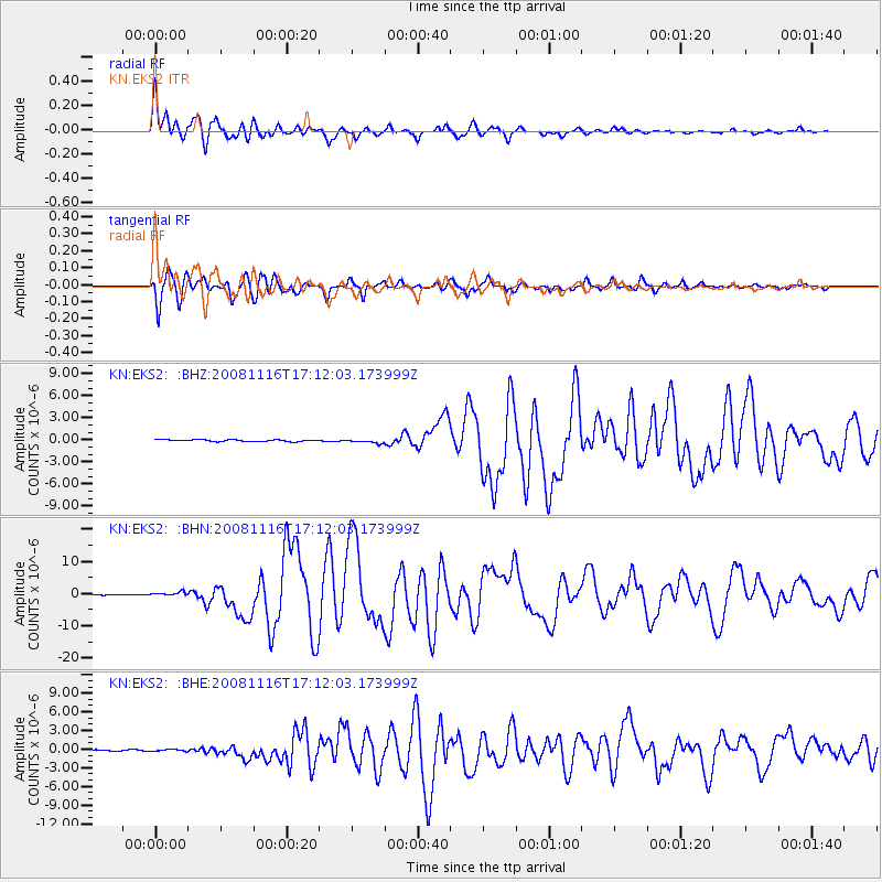
Earthquake location: Minahassa Peninsula, Sulawesi
Earthquake latitude/longitude: 1.3/122.1
Earthquake time(UTC): 2008/11/16 (321) 17:02:32 GMT
Earthquake Depth: 30 km
Earthquake Magnitude: 6.5 MB, 7.0 MS, 7.3 MW, 7.3 MW
Earthquake Catalog/Contributor: WHDF/NEIC
Network: KN Kyrgyz Seismic Telemetry Network
Station: EKS2 KN.EKS2
Lat/Lon: 42.66 N/73.78 E
Elevation: 1360 m
Distance: 59.6 deg
Az: 320.33 deg
Baz: 120.093 deg
Ray Param: 0.062001448
Estimated Moho Depth: 15.0 km
Estimated Crust Vp/Vs: 1.68
Assumed Crust Vp: 6.316 km/s
Estimated Crust Vs: 3.765 km/s
Estimated Crust Poisson's Ratio: 0.22
Radial Match: 95.127426 %
Radial Bump: 400
Transverse Match: 93.69543 %
Transverse Bump: 400
SOD ConfigId: 2658
Insert Time: 2010-03-08 19:53:44.034 +0000
GWidth: 2.5
Max Bumps: 400
Tol: 0.001

Signal To Noise

ChannelStoNSTALTA
KN:EKS2: :BHN:20081116T17:12:03.173999Z5.58187066.5202204E-71.1681067E-7
KN:EKS2: :BHE:20081116T17:12:03.173999Z1.1654011.3945748E-71.196648E-7
KN:EKS2: :BHZ:20081116T17:12:03.173999Z2.29540562.6833524E-71.1690101E-7
Arrivals
Ps1.7 SECOND
PpPs6.1 SECOND
PsPs/PpSs7.7 SECOND