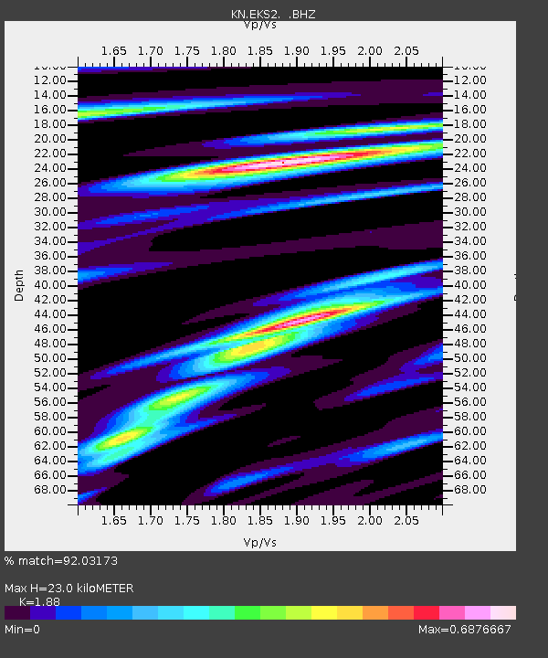
EKS2 KN.EKS2 - Earthquake Result Viewer
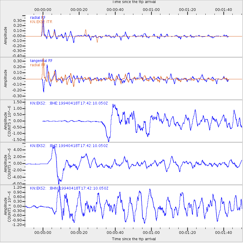
Earthquake location: Solomon Islands
Earthquake latitude/longitude: -6.5/154.9
Earthquake time(UTC): 1994/04/18 (108) 17:29:56 GMT
Earthquake Depth: 43 km
Earthquake Magnitude: 6.6 MB, 6.7 MS, 6.8 UNKNOWN, 6.7 MW
Earthquake Catalog/Contributor: WHDF/NEIC
Network: KN Kyrgyz Seismic Telemetry Network
Station: EKS2 KN.EKS2
Lat/Lon: 42.66 N/73.78 E
Elevation: 1360 m
Distance: 87.9 deg
Az: 313.169 deg
Baz: 100.733 deg
Ray Param: 0.04294163
Estimated Moho Depth: 23.0 km
Estimated Crust Vp/Vs: 1.88
Assumed Crust Vp: 6.316 km/s
Estimated Crust Vs: 3.359 km/s
Estimated Crust Poisson's Ratio: 0.30
Radial Match: 92.03173 %
Radial Bump: 400
Transverse Match: 92.501434 %
Transverse Bump: 400
SOD ConfigId: 4480
Insert Time: 2010-03-08 19:53:45.597 +0000
GWidth: 2.5
Max Bumps: 400
Tol: 0.001

Signal To Noise

ChannelStoNSTALTA
KN:EKS2: :BHZ:19940418T17:42:10.050Z13.3827037.4556027E-75.5710743E-8
KN:EKS2: :BHN:19940418T17:42:10.050Z1.11257124.7318796E-84.2531024E-8
KN:EKS2: :BHE:19940418T17:42:10.050Z8.1141942.0740877E-72.556123E-8
Arrivals
Ps3.3 SECOND
PpPs10 SECOND
PsPs/PpSs14 SECOND