EKS2 KN.EKS2 - Earthquake Result Viewer
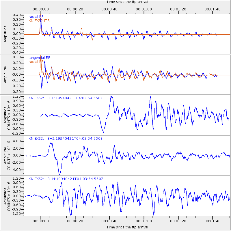
Earthquake location: Solomon Islands
Earthquake latitude/longitude: -5.7/154.1
Earthquake time(UTC): 1994/04/21 (111) 03:51:44 GMT
Earthquake Depth: 30 km
Earthquake Magnitude: 5.8 MB, 6.6 MS, 6.7 UNKNOWN, 6.6 MW
Earthquake Catalog/Contributor: WHDF/NEIC
Network: KN Kyrgyz Seismic Telemetry Network
Station: EKS2 KN.EKS2
Lat/Lon: 42.66 N/73.78 E
Elevation: 1360 m
Distance: 86.7 deg
Az: 313.257 deg
Baz: 100.733 deg
Ray Param: 0.04379826
Estimated Moho Depth: 48.75 km
Estimated Crust Vp/Vs: 1.81
Assumed Crust Vp: 6.316 km/s
Estimated Crust Vs: 3.499 km/s
Estimated Crust Poisson's Ratio: 0.28
Radial Match: 91.67985 %
Radial Bump: 400
Transverse Match: 88.83053 %
Transverse Bump: 400
SOD ConfigId: 4480
Insert Time: 2010-03-08 19:53:48.696 +0000
GWidth: 2.5
Max Bumps: 400
Tol: 0.001

Signal To Noise

ChannelStoNSTALTA
KN:EKS2: :BHZ:19940421T04:03:54.550Z10.7429885.8414173E-75.4374237E-8
KN:EKS2: :BHN:19940421T04:03:54.550Z1.23009555.329778E-84.332816E-8
KN:EKS2: :BHE:19940421T04:03:54.550Z2.3284321.2865165E-75.5252485E-8
Arrivals
Ps6.4 SECOND
PpPs21 SECOND
PsPs/PpSs28 SECOND