
EKS2 KN.EKS2 - Earthquake Result Viewer
| ||||||||||||||||||
| ||||||||||||||||||
| ||||||||||||||||||
|
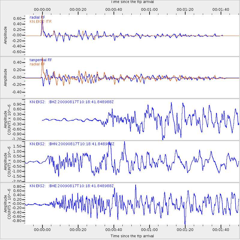
Signal To Noise
| Channel | StoN | STA | LTA |
| KN:EKS2: :BHN:20090817T10:18:41.848988Z | 4.9959893 | 3.1627636E-7 | 6.3306054E-8 |
| KN:EKS2: :BHE:20090817T10:18:41.848988Z | 0.68376005 | 2.834022E-8 | 4.144761E-8 |
| KN:EKS2: :BHZ:20090817T10:18:41.848988Z | 3.4871068 | 1.4744899E-7 | 4.2284046E-8 |
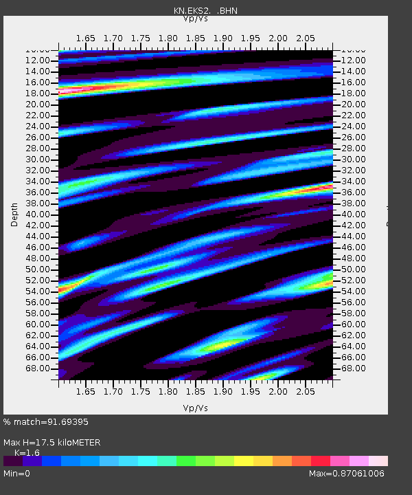
| Arrivals | |
| Ps | 1.8 SECOND |
| PpPs | 6.7 SECOND |
| PsPs/PpSs | 8.5 SECOND |

