You are here: Home > Network List > GS - US Geological Survey Networks Stations List
> Station OK031 S. Brethren Rd., Cushing, OK, USA > Earthquake Result Viewer
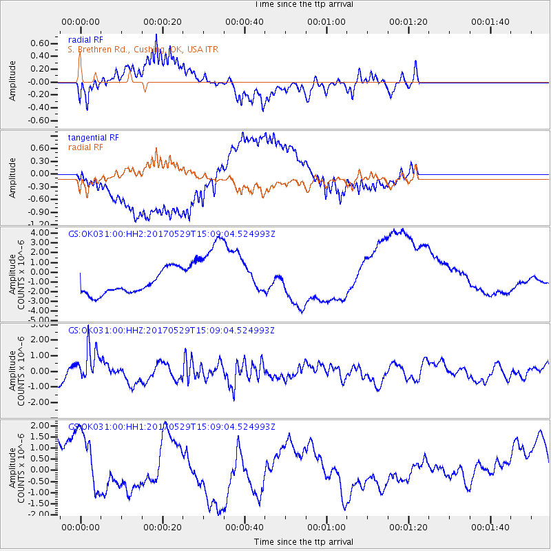
OK031 S. Brethren Rd., Cushing, OK, USA - Earthquake Result Viewer
*The percent match for this event was below the threshold and hence no stack was calculated.
| Earthquake location: |
S. Chile-Argentina Border Region |
| Earthquake latitude/longitude: |
-37.3/-71.6 |
| Earthquake time(UTC): |
2017/05/29 (149) 14:57:54 GMT |
| Earthquake Depth: |
87 km |
| Earthquake Magnitude: |
5.7 Mwr |
| Earthquake Catalog/Contributor: |
NEIC PDE/us |
|
| Network: |
GS US Geological Survey Networks |
| Station: |
OK031 S. Brethren Rd., Cushing, OK, USA |
| Lat/Lon: |
35.95 N/96.84 W |
| Elevation: |
290 m |
|
| Distance: |
76.6 deg |
| Az: |
339.181 deg |
| Baz: |
159.568 deg |
| Ray Param: |
$rayparam |
*The percent match for this event was below the threshold and hence was not used in the summary stack. |
|
| Radial Match: |
54.23929 % |
| Radial Bump: |
400 |
| Transverse Match: |
56.116333 % |
| Transverse Bump: |
400 |
| SOD ConfigId: |
2028011 |
| Insert Time: |
2017-06-12 15:06:44.198 +0000 |
| GWidth: |
2.5 |
| Max Bumps: |
400 |
| Tol: |
0.001 |
|
Signal To Noise
| Channel | StoN | STA | LTA |
| GS:OK031:00:HHZ:20170529T15:09:04.524993Z | 2.1323397 | 1.209949E-6 | 5.674279E-7 |
| GS:OK031:00:HH1:20170529T15:09:04.524993Z | 1.5870526 | 1.535171E-6 | 9.673095E-7 |
| GS:OK031:00:HH2:20170529T15:09:04.524993Z | 3.3637037 | 3.86462E-6 | 1.148918E-6 |
| Arrivals |
| Ps | |
| PpPs | |
| PsPs/PpSs | |


