You are here: Home > Network List > TS - TERRAscope (Southern California Seismic Network) Stations List
> Station SBC Santa Barbara, California, USA > Earthquake Result Viewer
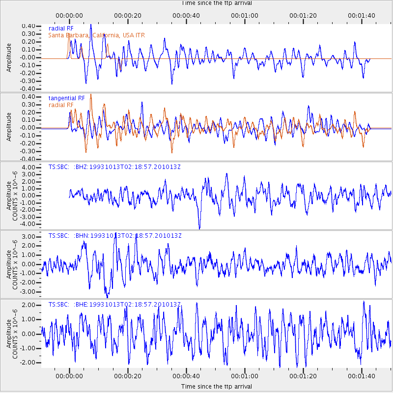
SBC Santa Barbara, California, USA - Earthquake Result Viewer
*The percent match for this event was below the threshold and hence no stack was calculated.
| Earthquake location: |
Eastern New Guinea Reg., P.N.G. |
| Earthquake latitude/longitude: |
-5.9/146.0 |
| Earthquake time(UTC): |
1993/10/13 (286) 02:06:00 GMT |
| Earthquake Depth: |
24 km |
| Earthquake Magnitude: |
6.4 MB, 7.1 MS, 6.7 UNKNOWN, 7.1 ML |
| Earthquake Catalog/Contributor: |
WHDF/NEIC |
|
| Network: |
TS TERRAscope (Southern California Seismic Network) |
| Station: |
SBC Santa Barbara, California, USA |
| Lat/Lon: |
34.44 N/119.71 W |
| Elevation: |
90 m |
|
| Distance: |
96.8 deg |
| Az: |
56.105 deg |
| Baz: |
267.505 deg |
| Ray Param: |
$rayparam |
*The percent match for this event was below the threshold and hence was not used in the summary stack. |
|
| Radial Match: |
69.42548 % |
| Radial Bump: |
400 |
| Transverse Match: |
63.99006 % |
| Transverse Bump: |
400 |
| SOD ConfigId: |
4480 |
| Insert Time: |
2010-02-26 14:49:43.466 +0000 |
| GWidth: |
2.5 |
| Max Bumps: |
400 |
| Tol: |
0.001 |
|
Signal To Noise
| Channel | StoN | STA | LTA |
| TS:SBC: :BHN:19931013T02:18:57.201013Z | 1.9504113 | 9.0646205E-7 | 4.647543E-7 |
| TS:SBC: :BHE:19931013T02:18:57.201013Z | 1.1681242 | 9.3631695E-7 | 8.015559E-7 |
| TS:SBC: :BHZ:19931013T02:18:57.201013Z | 1.4378521 | 1.0018289E-6 | 6.967538E-7 |
| Arrivals |
| Ps | |
| PpPs | |
| PsPs/PpSs | |


