You are here: Home > Network List > US - United States National Seismic Network Stations List
> Station CBKS Cedar Bluff, Kansas, USA > Earthquake Result Viewer
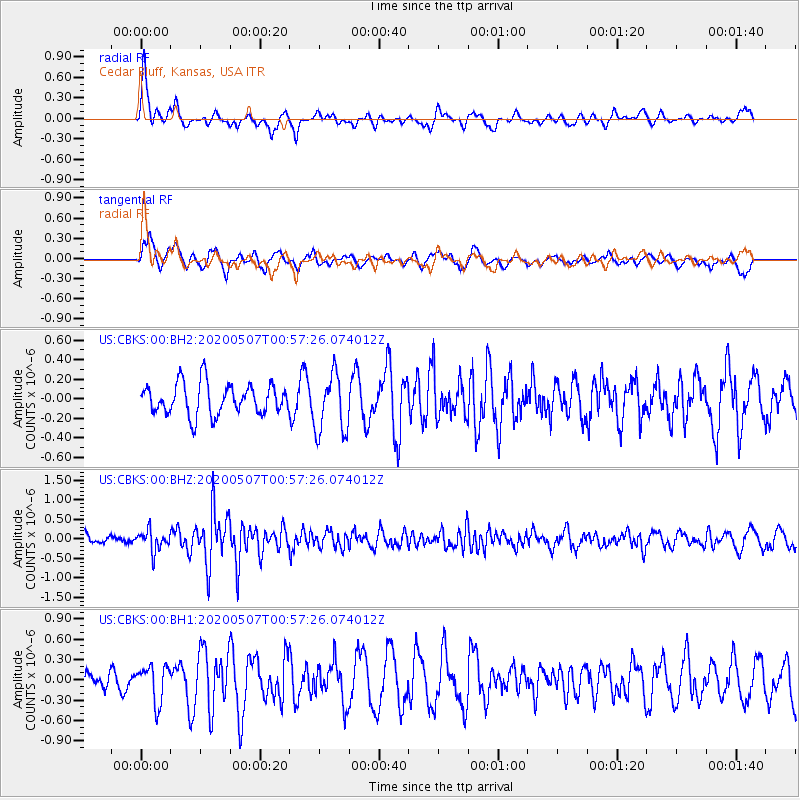
CBKS Cedar Bluff, Kansas, USA - Earthquake Result Viewer
*The percent match for this event was below the threshold and hence no stack was calculated.
| Earthquake location: |
Northern Peru |
| Earthquake latitude/longitude: |
-5.7/-76.7 |
| Earthquake time(UTC): |
2020/05/07 (128) 00:49:10 GMT |
| Earthquake Depth: |
24 km |
| Earthquake Magnitude: |
5.3 Mww |
| Earthquake Catalog/Contributor: |
NEIC PDE/us |
|
| Network: |
US United States National Seismic Network |
| Station: |
CBKS Cedar Bluff, Kansas, USA |
| Lat/Lon: |
38.81 N/99.74 W |
| Elevation: |
677 m |
|
| Distance: |
49.2 deg |
| Az: |
336.208 deg |
| Baz: |
149.079 deg |
| Ray Param: |
$rayparam |
*The percent match for this event was below the threshold and hence was not used in the summary stack. |
|
| Radial Match: |
70.40139 % |
| Radial Bump: |
375 |
| Transverse Match: |
60.793987 % |
| Transverse Bump: |
400 |
| SOD ConfigId: |
21166931 |
| Insert Time: |
2020-05-21 01:05:13.872 +0000 |
| GWidth: |
2.5 |
| Max Bumps: |
400 |
| Tol: |
0.001 |
|
Signal To Noise
| Channel | StoN | STA | LTA |
| US:CBKS:00:BHZ:20200507T00:57:26.074012Z | 1.8801191 | 2.628447E-7 | 1.3980215E-7 |
| US:CBKS:00:BH1:20200507T00:57:26.074012Z | 1.3903977 | 2.7169068E-7 | 1.9540501E-7 |
| US:CBKS:00:BH2:20200507T00:57:26.074012Z | 1.9300549 | 3.0529063E-7 | 1.5817716E-7 |
| Arrivals |
| Ps | |
| PpPs | |
| PsPs/PpSs | |


