You are here: Home > Network List > NE - New England Seismic Network Stations List
> Station PQI Presque Isle, ME, USA > Earthquake Result Viewer
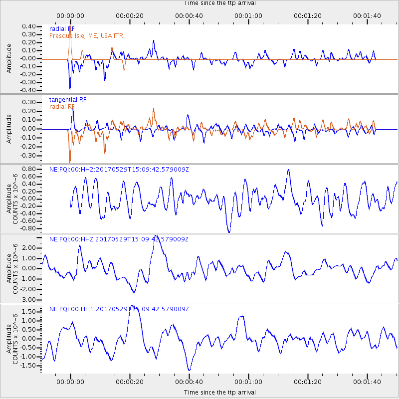
PQI Presque Isle, ME, USA - Earthquake Result Viewer
*The percent match for this event was below the threshold and hence no stack was calculated.
| Earthquake location: |
S. Chile-Argentina Border Region |
| Earthquake latitude/longitude: |
-37.3/-71.6 |
| Earthquake time(UTC): |
2017/05/29 (149) 14:57:54 GMT |
| Earthquake Depth: |
87 km |
| Earthquake Magnitude: |
5.7 Mwr |
| Earthquake Catalog/Contributor: |
NEIC PDE/us |
|
| Network: |
NE New England Seismic Network |
| Station: |
PQI Presque Isle, ME, USA |
| Lat/Lon: |
46.67 N/68.02 W |
| Elevation: |
162 m |
|
| Distance: |
83.7 deg |
| Az: |
2.493 deg |
| Baz: |
182.885 deg |
| Ray Param: |
$rayparam |
*The percent match for this event was below the threshold and hence was not used in the summary stack. |
|
| Radial Match: |
51.54765 % |
| Radial Bump: |
400 |
| Transverse Match: |
69.064064 % |
| Transverse Bump: |
400 |
| SOD ConfigId: |
2028011 |
| Insert Time: |
2017-06-12 15:07:42.777 +0000 |
| GWidth: |
2.5 |
| Max Bumps: |
400 |
| Tol: |
0.001 |
|
Signal To Noise
| Channel | StoN | STA | LTA |
| NE:PQI:00:HHZ:20170529T15:09:42.579009Z | 1.912738 | 1.056967E-6 | 5.5259375E-7 |
| NE:PQI:00:HH1:20170529T15:09:42.579009Z | 0.8585567 | 5.4344576E-7 | 6.3297597E-7 |
| NE:PQI:00:HH2:20170529T15:09:42.579009Z | 0.87323016 | 2.7610537E-7 | 3.1618853E-7 |
| Arrivals |
| Ps | |
| PpPs | |
| PsPs/PpSs | |


