You are here: Home > Network List > US - United States National Seismic Network Stations List
> Station LKWY Lake (Yellowstone--Lake), Wyoming, USA > Earthquake Result Viewer
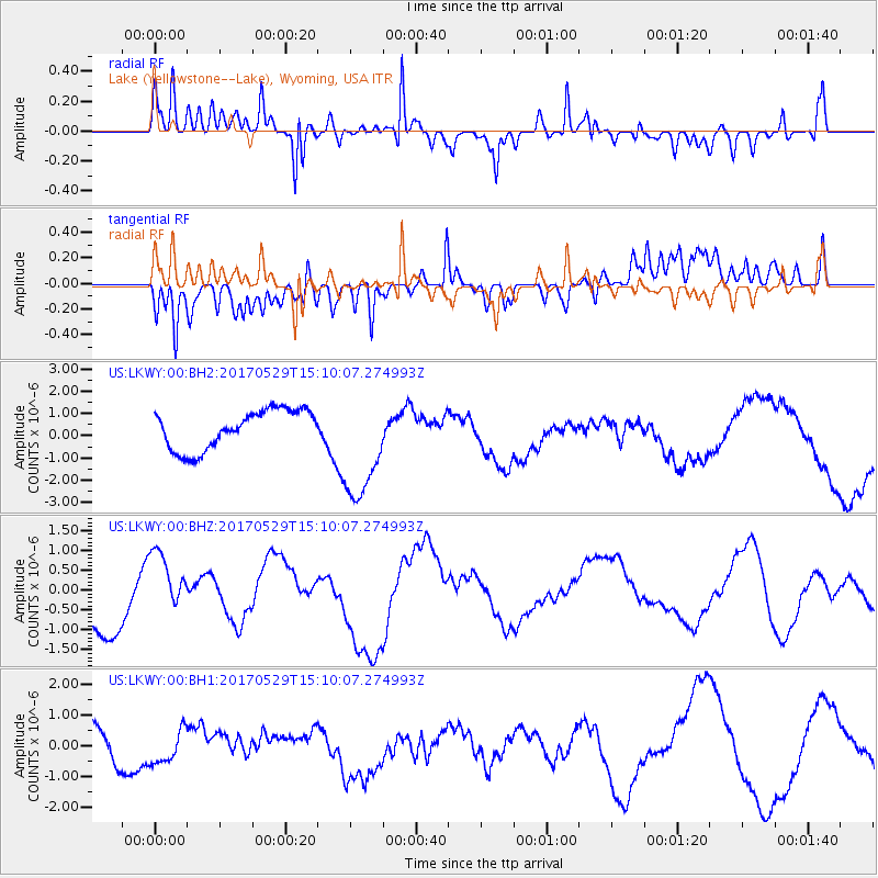
LKWY Lake (Yellowstone--Lake), Wyoming, USA - Earthquake Result Viewer
*The percent match for this event was below the threshold and hence no stack was calculated.
| Earthquake location: |
S. Chile-Argentina Border Region |
| Earthquake latitude/longitude: |
-37.3/-71.6 |
| Earthquake time(UTC): |
2017/05/29 (149) 14:57:54 GMT |
| Earthquake Depth: |
87 km |
| Earthquake Magnitude: |
5.7 Mwr |
| Earthquake Catalog/Contributor: |
NEIC PDE/us |
|
| Network: |
US United States National Seismic Network |
| Station: |
LKWY Lake (Yellowstone--Lake), Wyoming, USA |
| Lat/Lon: |
44.57 N/110.40 W |
| Elevation: |
2424 m |
|
| Distance: |
88.8 deg |
| Az: |
333.396 deg |
| Baz: |
150.047 deg |
| Ray Param: |
$rayparam |
*The percent match for this event was below the threshold and hence was not used in the summary stack. |
|
| Radial Match: |
72.71751 % |
| Radial Bump: |
400 |
| Transverse Match: |
40.872787 % |
| Transverse Bump: |
400 |
| SOD ConfigId: |
2028011 |
| Insert Time: |
2017-06-12 15:09:03.452 +0000 |
| GWidth: |
2.5 |
| Max Bumps: |
400 |
| Tol: |
0.001 |
|
Signal To Noise
| Channel | StoN | STA | LTA |
| US:LKWY:00:BHZ:20170529T15:10:07.274993Z | 1.2751237 | 8.449478E-7 | 6.626399E-7 |
| US:LKWY:00:BH1:20170529T15:10:07.274993Z | 0.70305747 | 5.0841373E-7 | 7.2314674E-7 |
| US:LKWY:00:BH2:20170529T15:10:07.274993Z | 2.9346495 | 2.5454763E-6 | 8.6738675E-7 |
| Arrivals |
| Ps | |
| PpPs | |
| PsPs/PpSs | |


