You are here: Home > Network List > TA - USArray Transportable Network (new EarthScope stations) Stations List
> Station H16K Elim, AK, USA > Earthquake Result Viewer
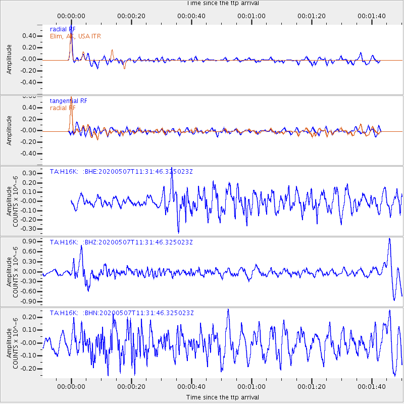
H16K Elim, AK, USA - Earthquake Result Viewer
*The percent match for this event was below the threshold and hence no stack was calculated.
| Earthquake location: |
Solomon Islands |
| Earthquake latitude/longitude: |
-4.5/154.7 |
| Earthquake time(UTC): |
2020/05/07 (128) 11:21:19 GMT |
| Earthquake Depth: |
466 km |
| Earthquake Magnitude: |
6.1 Mww |
| Earthquake Catalog/Contributor: |
NEIC PDE/us |
|
| Network: |
TA USArray Transportable Network (new EarthScope stations) |
| Station: |
H16K Elim, AK, USA |
| Lat/Lon: |
64.64 N/162.24 W |
| Elevation: |
216 m |
|
| Distance: |
75.9 deg |
| Az: |
17.648 deg |
| Baz: |
224.574 deg |
| Ray Param: |
$rayparam |
*The percent match for this event was below the threshold and hence was not used in the summary stack. |
|
| Radial Match: |
68.18065 % |
| Radial Bump: |
355 |
| Transverse Match: |
46.47591 % |
| Transverse Bump: |
400 |
| SOD ConfigId: |
21166931 |
| Insert Time: |
2020-05-21 11:34:26.572 +0000 |
| GWidth: |
2.5 |
| Max Bumps: |
400 |
| Tol: |
0.001 |
|
Signal To Noise
| Channel | StoN | STA | LTA |
| TA:H16K: :BHZ:20200507T11:31:46.325023Z | 4.9452167 | 3.0653183E-7 | 6.198552E-8 |
| TA:H16K: :BHN:20200507T11:31:46.325023Z | 1.2791282 | 8.723503E-8 | 6.819882E-8 |
| TA:H16K: :BHE:20200507T11:31:46.325023Z | 3.394701 | 1.2996904E-7 | 3.8285858E-8 |
| Arrivals |
| Ps | |
| PpPs | |
| PsPs/PpSs | |


