You are here: Home > Network List > TA - USArray Transportable Network (new EarthScope stations) Stations List
> Station H31M Peel River, Yukon, CAN > Earthquake Result Viewer
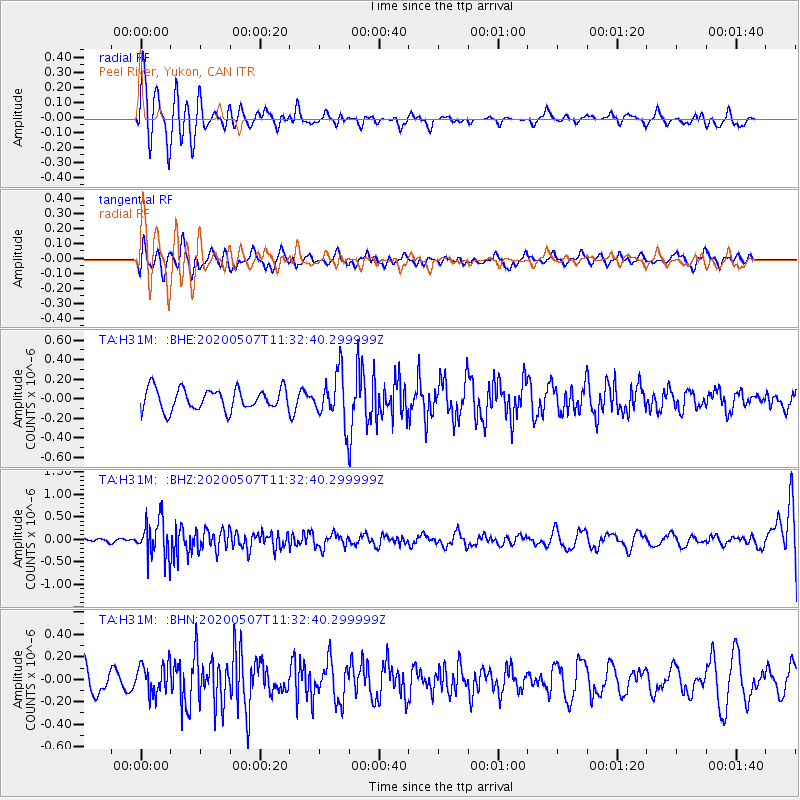
H31M Peel River, Yukon, CAN - Earthquake Result Viewer
*The percent match for this event was below the threshold and hence no stack was calculated.
| Earthquake location: |
Solomon Islands |
| Earthquake latitude/longitude: |
-4.5/154.7 |
| Earthquake time(UTC): |
2020/05/07 (128) 11:21:19 GMT |
| Earthquake Depth: |
466 km |
| Earthquake Magnitude: |
6.1 Mww |
| Earthquake Catalog/Contributor: |
NEIC PDE/us |
|
| Network: |
TA USArray Transportable Network (new EarthScope stations) |
| Station: |
H31M Peel River, Yukon, CAN |
| Lat/Lon: |
65.81 N/134.34 W |
| Elevation: |
642 m |
|
| Distance: |
86.3 deg |
| Az: |
22.976 deg |
| Baz: |
250.789 deg |
| Ray Param: |
$rayparam |
*The percent match for this event was below the threshold and hence was not used in the summary stack. |
|
| Radial Match: |
65.70337 % |
| Radial Bump: |
337 |
| Transverse Match: |
34.564045 % |
| Transverse Bump: |
400 |
| SOD ConfigId: |
21166931 |
| Insert Time: |
2020-05-21 11:34:34.675 +0000 |
| GWidth: |
2.5 |
| Max Bumps: |
400 |
| Tol: |
0.001 |
|
Signal To Noise
| Channel | StoN | STA | LTA |
| TA:H31M: :BHZ:20200507T11:32:40.299999Z | 5.6118746 | 4.1456315E-7 | 7.387249E-8 |
| TA:H31M: :BHN:20200507T11:32:40.299999Z | 1.3400328 | 1.360093E-7 | 1.01496994E-7 |
| TA:H31M: :BHE:20200507T11:32:40.299999Z | 2.2769873 | 2.481331E-7 | 1.08974305E-7 |
| Arrivals |
| Ps | |
| PpPs | |
| PsPs/PpSs | |


