You are here: Home > Network List > US - United States National Seismic Network Stations List
> Station EGMT Eagleton, Montana, USA > Earthquake Result Viewer
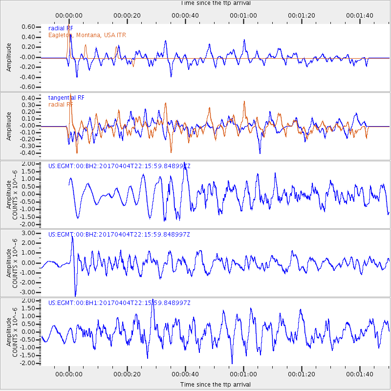
EGMT Eagleton, Montana, USA - Earthquake Result Viewer
*The percent match for this event was below the threshold and hence no stack was calculated.
| Earthquake location: |
Andreanof Islands, Aleutian Is. |
| Earthquake latitude/longitude: |
51.3/-176.4 |
| Earthquake time(UTC): |
2017/04/04 (094) 22:08:40 GMT |
| Earthquake Depth: |
13 km |
| Earthquake Magnitude: |
5.5 Mww |
| Earthquake Catalog/Contributor: |
NEIC PDE/us |
|
| Network: |
US United States National Seismic Network |
| Station: |
EGMT Eagleton, Montana, USA |
| Lat/Lon: |
48.02 N/109.75 W |
| Elevation: |
1055 m |
|
| Distance: |
42.0 deg |
| Az: |
67.218 deg |
| Baz: |
300.365 deg |
| Ray Param: |
$rayparam |
*The percent match for this event was below the threshold and hence was not used in the summary stack. |
|
| Radial Match: |
53.221718 % |
| Radial Bump: |
400 |
| Transverse Match: |
58.770363 % |
| Transverse Bump: |
400 |
| SOD ConfigId: |
2140511 |
| Insert Time: |
2017-06-12 21:51:01.023 +0000 |
| GWidth: |
2.5 |
| Max Bumps: |
400 |
| Tol: |
0.001 |
|
Signal To Noise
| Channel | StoN | STA | LTA |
| US:EGMT:00:BHZ:20170404T22:15:59.848997Z | 3.8178618 | 1.3887236E-6 | 3.637438E-7 |
| US:EGMT:00:BH1:20170404T22:15:59.848997Z | 0.69727355 | 3.5611072E-7 | 5.107188E-7 |
| US:EGMT:00:BH2:20170404T22:15:59.848997Z | 1.6697172 | 9.110583E-7 | 5.456363E-7 |
| Arrivals |
| Ps | |
| PpPs | |
| PsPs/PpSs | |


