You are here: Home > Network List > US - United States National Seismic Network Stations List
> Station HAWA Hanford, Washington, USA > Earthquake Result Viewer
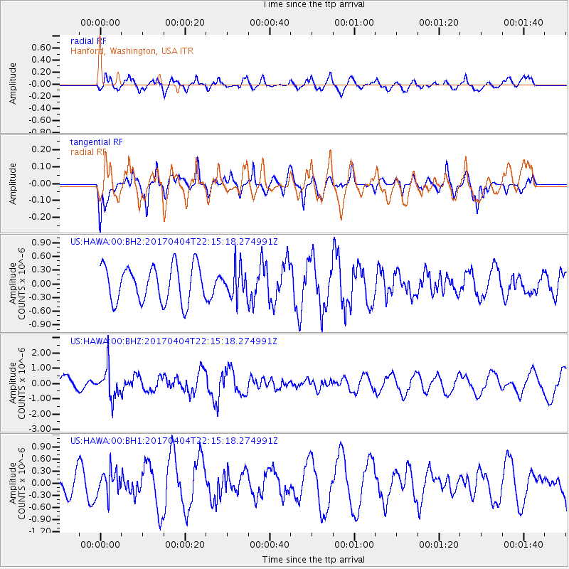
HAWA Hanford, Washington, USA - Earthquake Result Viewer
*The percent match for this event was below the threshold and hence no stack was calculated.
| Earthquake location: |
Andreanof Islands, Aleutian Is. |
| Earthquake latitude/longitude: |
51.3/-176.4 |
| Earthquake time(UTC): |
2017/04/04 (094) 22:08:40 GMT |
| Earthquake Depth: |
13 km |
| Earthquake Magnitude: |
5.5 Mww |
| Earthquake Catalog/Contributor: |
NEIC PDE/us |
|
| Network: |
US United States National Seismic Network |
| Station: |
HAWA Hanford, Washington, USA |
| Lat/Lon: |
46.39 N/119.53 W |
| Elevation: |
364 m |
|
| Distance: |
37.0 deg |
| Az: |
74.629 deg |
| Baz: |
298.933 deg |
| Ray Param: |
$rayparam |
*The percent match for this event was below the threshold and hence was not used in the summary stack. |
|
| Radial Match: |
62.40606 % |
| Radial Bump: |
400 |
| Transverse Match: |
66.06359 % |
| Transverse Bump: |
400 |
| SOD ConfigId: |
2140511 |
| Insert Time: |
2017-06-12 21:51:11.994 +0000 |
| GWidth: |
2.5 |
| Max Bumps: |
400 |
| Tol: |
0.001 |
|
Signal To Noise
| Channel | StoN | STA | LTA |
| US:HAWA:00:BHZ:20170404T22:15:18.274991Z | 2.1841722 | 9.959327E-7 | 4.5597722E-7 |
| US:HAWA:00:BH1:20170404T22:15:18.274991Z | 1.0609607 | 2.9429046E-7 | 2.773811E-7 |
| US:HAWA:00:BH2:20170404T22:15:18.274991Z | 0.8243593 | 3.2629566E-7 | 3.958173E-7 |
| Arrivals |
| Ps | |
| PpPs | |
| PsPs/PpSs | |


