You are here: Home > Network List > CN - Canadian National Seismograph Network Stations List
> Station INK INUVIK, NT > Earthquake Result Viewer
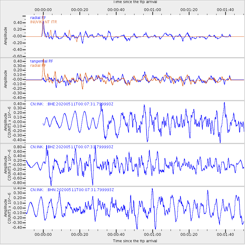
INK INUVIK, NT - Earthquake Result Viewer
*The percent match for this event was below the threshold and hence no stack was calculated.
| Earthquake location: |
Near East Coast Of Honshu, Japan |
| Earthquake latitude/longitude: |
36.4/141.1 |
| Earthquake time(UTC): |
2020/05/10 (131) 23:58:33 GMT |
| Earthquake Depth: |
30 km |
| Earthquake Magnitude: |
5.8 Mww |
| Earthquake Catalog/Contributor: |
NEIC PDE/us |
|
| Network: |
CN Canadian National Seismograph Network |
| Station: |
INK INUVIK, NT |
| Lat/Lon: |
68.31 N/133.53 W |
| Elevation: |
44 m |
|
| Distance: |
55.0 deg |
| Az: |
26.879 deg |
| Baz: |
281.167 deg |
| Ray Param: |
$rayparam |
*The percent match for this event was below the threshold and hence was not used in the summary stack. |
|
| Radial Match: |
71.43949 % |
| Radial Bump: |
400 |
| Transverse Match: |
64.783745 % |
| Transverse Bump: |
400 |
| SOD ConfigId: |
21166931 |
| Insert Time: |
2020-05-25 00:05:50.807 +0000 |
| GWidth: |
2.5 |
| Max Bumps: |
400 |
| Tol: |
0.001 |
|
Signal To Noise
| Channel | StoN | STA | LTA |
| CN:INK: :BHZ:20200511T00:07:31.799993Z | 3.9519827 | 4.6096923E-7 | 1.16642525E-7 |
| CN:INK: :BHN:20200511T00:07:31.799993Z | 1.7814589 | 1.4890587E-7 | 8.358648E-8 |
| CN:INK: :BHE:20200511T00:07:31.799993Z | 1.9037882 | 2.356571E-7 | 1.2378325E-7 |
| Arrivals |
| Ps | |
| PpPs | |
| PsPs/PpSs | |


