You are here: Home > Network List > TA - USArray Transportable Network (new EarthScope stations) Stations List
> Station M31M Drury Creek, Yukon, CA > Earthquake Result Viewer
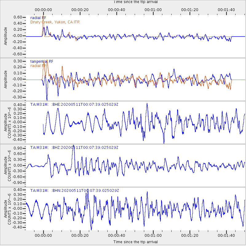
M31M Drury Creek, Yukon, CA - Earthquake Result Viewer
*The percent match for this event was below the threshold and hence no stack was calculated.
| Earthquake location: |
Near East Coast Of Honshu, Japan |
| Earthquake latitude/longitude: |
36.4/141.1 |
| Earthquake time(UTC): |
2020/05/10 (131) 23:58:33 GMT |
| Earthquake Depth: |
30 km |
| Earthquake Magnitude: |
5.8 Mww |
| Earthquake Catalog/Contributor: |
NEIC PDE/us |
|
| Network: |
TA USArray Transportable Network (new EarthScope stations) |
| Station: |
M31M Drury Creek, Yukon, CA |
| Lat/Lon: |
62.20 N/134.39 W |
| Elevation: |
639 m |
|
| Distance: |
56.1 deg |
| Az: |
34.227 deg |
| Baz: |
284.542 deg |
| Ray Param: |
$rayparam |
*The percent match for this event was below the threshold and hence was not used in the summary stack. |
|
| Radial Match: |
47.898693 % |
| Radial Bump: |
400 |
| Transverse Match: |
61.119766 % |
| Transverse Bump: |
400 |
| SOD ConfigId: |
21166931 |
| Insert Time: |
2020-05-25 00:17:06.992 +0000 |
| GWidth: |
2.5 |
| Max Bumps: |
400 |
| Tol: |
0.001 |
|
Signal To Noise
| Channel | StoN | STA | LTA |
| TA:M31M: :BHZ:20200511T00:07:39.025029Z | 4.106112 | 3.080223E-7 | 7.501556E-8 |
| TA:M31M: :BHN:20200511T00:07:39.025029Z | 1.3069149 | 1.224369E-7 | 9.368391E-8 |
| TA:M31M: :BHE:20200511T00:07:39.025029Z | 0.9512681 | 1.4412535E-7 | 1.5150866E-7 |
| Arrivals |
| Ps | |
| PpPs | |
| PsPs/PpSs | |


