You are here: Home > Network List > US - United States National Seismic Network Stations List
> Station EGMT Eagleton, Montana, USA > Earthquake Result Viewer
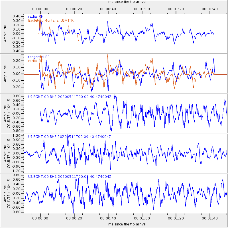
EGMT Eagleton, Montana, USA - Earthquake Result Viewer
*The percent match for this event was below the threshold and hence no stack was calculated.
| Earthquake location: |
Near East Coast Of Honshu, Japan |
| Earthquake latitude/longitude: |
36.4/141.1 |
| Earthquake time(UTC): |
2020/05/10 (131) 23:58:33 GMT |
| Earthquake Depth: |
30 km |
| Earthquake Magnitude: |
5.8 Mww |
| Earthquake Catalog/Contributor: |
NEIC PDE/us |
|
| Network: |
US United States National Seismic Network |
| Station: |
EGMT Eagleton, Montana, USA |
| Lat/Lon: |
48.02 N/109.75 W |
| Elevation: |
1055 m |
|
| Distance: |
74.9 deg |
| Az: |
41.076 deg |
| Baz: |
307.848 deg |
| Ray Param: |
$rayparam |
*The percent match for this event was below the threshold and hence was not used in the summary stack. |
|
| Radial Match: |
62.267067 % |
| Radial Bump: |
400 |
| Transverse Match: |
48.42859 % |
| Transverse Bump: |
400 |
| SOD ConfigId: |
21166931 |
| Insert Time: |
2020-05-25 00:18:56.169 +0000 |
| GWidth: |
2.5 |
| Max Bumps: |
400 |
| Tol: |
0.001 |
|
Signal To Noise
| Channel | StoN | STA | LTA |
| US:EGMT:00:BHZ:20200511T00:09:40.474004Z | 2.9922853 | 4.276807E-7 | 1.4292779E-7 |
| US:EGMT:00:BH1:20200511T00:09:40.474004Z | 1.0216345 | 2.9288228E-7 | 2.866801E-7 |
| US:EGMT:00:BH2:20200511T00:09:40.474004Z | 1.6538529 | 3.0145054E-7 | 1.8227166E-7 |
| Arrivals |
| Ps | |
| PpPs | |
| PsPs/PpSs | |


