You are here: Home > Network List > US - United States National Seismic Network Stations List
> Station HAWA Hanford, Washington, USA > Earthquake Result Viewer
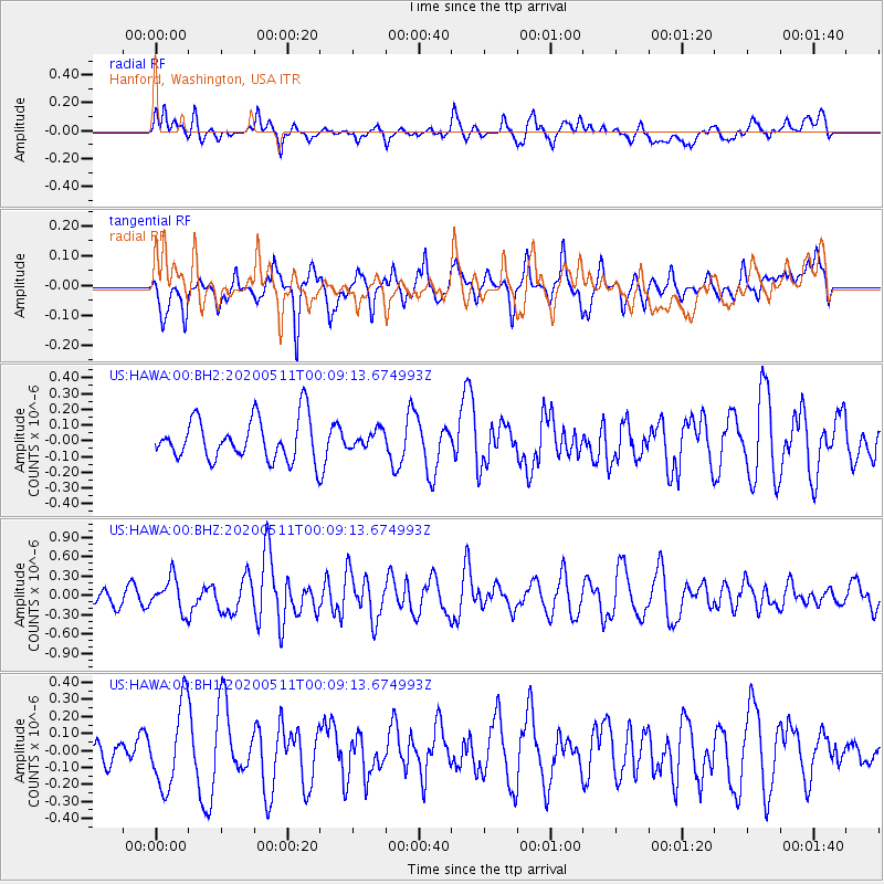
HAWA Hanford, Washington, USA - Earthquake Result Viewer
*The percent match for this event was below the threshold and hence no stack was calculated.
| Earthquake location: |
Near East Coast Of Honshu, Japan |
| Earthquake latitude/longitude: |
36.4/141.1 |
| Earthquake time(UTC): |
2020/05/10 (131) 23:58:33 GMT |
| Earthquake Depth: |
30 km |
| Earthquake Magnitude: |
5.8 Mww |
| Earthquake Catalog/Contributor: |
NEIC PDE/us |
|
| Network: |
US United States National Seismic Network |
| Station: |
HAWA Hanford, Washington, USA |
| Lat/Lon: |
46.39 N/119.53 W |
| Elevation: |
364 m |
|
| Distance: |
70.4 deg |
| Az: |
46.481 deg |
| Baz: |
302.302 deg |
| Ray Param: |
$rayparam |
*The percent match for this event was below the threshold and hence was not used in the summary stack. |
|
| Radial Match: |
59.18675 % |
| Radial Bump: |
400 |
| Transverse Match: |
61.12388 % |
| Transverse Bump: |
400 |
| SOD ConfigId: |
21166931 |
| Insert Time: |
2020-05-25 00:18:58.801 +0000 |
| GWidth: |
2.5 |
| Max Bumps: |
400 |
| Tol: |
0.001 |
|
Signal To Noise
| Channel | StoN | STA | LTA |
| US:HAWA:00:BHZ:20200511T00:09:13.674993Z | 1.4813191 | 2.5796484E-7 | 1.7414537E-7 |
| US:HAWA:00:BH1:20200511T00:09:13.674993Z | 3.544012 | 2.4058764E-7 | 6.788567E-8 |
| US:HAWA:00:BH2:20200511T00:09:13.674993Z | 0.41170377 | 5.4075294E-8 | 1.3134515E-7 |
| Arrivals |
| Ps | |
| PpPs | |
| PsPs/PpSs | |


