KBK KN.KBK - Earthquake Result Viewer
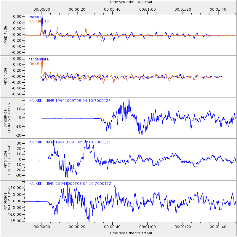
Earthquake location: Kuril Islands
Earthquake latitude/longitude: 43.9/147.9
Earthquake time(UTC): 1994/10/09 (282) 07:55:38 GMT
Earthquake Depth: 23 km
Earthquake Magnitude: 6.5 MB, 7.0 MS, 6.7 UNKNOWN, 7.3 MW
Earthquake Catalog/Contributor: WHDF/NEIC
Network: KN Kyrgyz Seismic Telemetry Network
Station: KBK KN.KBK
Lat/Lon: 42.66 N/74.95 E
Elevation: 1760 m
Distance: 51.5 deg
Az: 295.648 deg
Baz: 62.052 deg
Ray Param: 0.06735448
Estimated Moho Depth: 60.0 km
Estimated Crust Vp/Vs: 1.89
Assumed Crust Vp: 6.306 km/s
Estimated Crust Vs: 3.328 km/s
Estimated Crust Poisson's Ratio: 0.31
Radial Match: 96.7478 %
Radial Bump: 400
Transverse Match: 89.32074 %
Transverse Bump: 400
SOD ConfigId: 4480
Insert Time: 2010-03-08 19:59:51.423 +0000
GWidth: 2.5
Max Bumps: 400
Tol: 0.001

Signal To Noise

ChannelStoNSTALTA
KN:KBK: :BHZ:19941009T08:04:10.700012Z30.0872273.1054112E-61.0321361E-7
KN:KBK: :BHN:19941009T08:04:10.700012Z9.3271058.0290937E-78.608345E-8
KN:KBK: :BHE:19941009T08:04:10.700012Z24.0952631.3556822E-65.6263435E-8
Arrivals
Ps9.0 SECOND
PpPs26 SECOND
PsPs/PpSs35 SECOND