You are here: Home > Network List > AV - Alaska Volcano Observatory Stations List
> Station AMKA Regional Station, Amchitka Island, Alaska > Earthquake Result Viewer
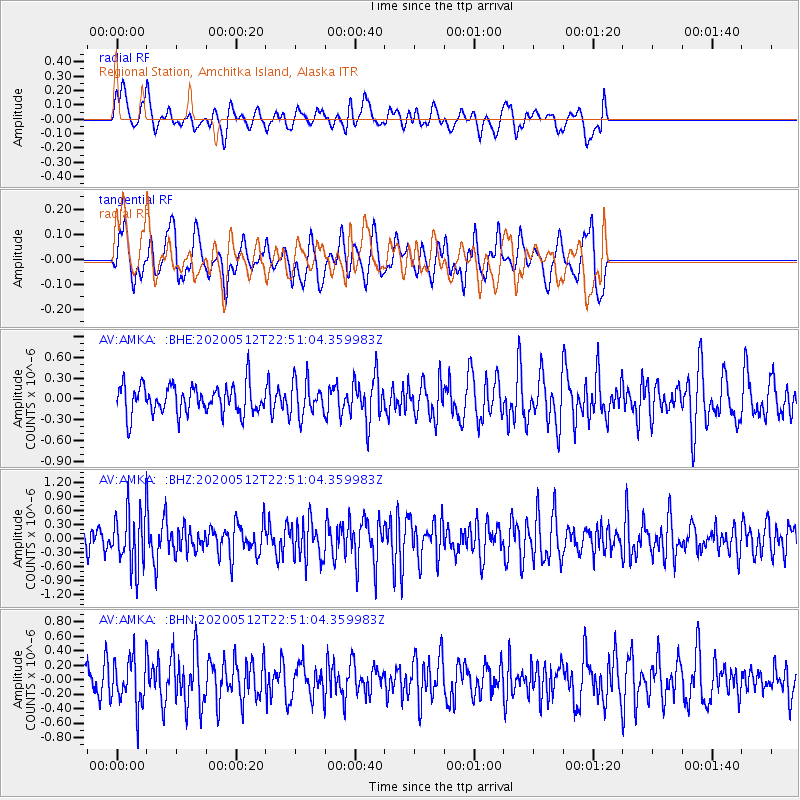
AMKA Regional Station, Amchitka Island, Alaska - Earthquake Result Viewer
*The percent match for this event was below the threshold and hence no stack was calculated.
| Earthquake location: |
Santa Cruz Islands |
| Earthquake latitude/longitude: |
-12.1/166.6 |
| Earthquake time(UTC): |
2020/05/12 (133) 22:41:12 GMT |
| Earthquake Depth: |
107 km |
| Earthquake Magnitude: |
6.6 mww |
| Earthquake Catalog/Contributor: |
NEIC PDE/us |
|
| Network: |
AV Alaska Volcano Observatory |
| Station: |
AMKA Regional Station, Amchitka Island, Alaska |
| Lat/Lon: |
51.38 N/179.30 E |
| Elevation: |
116 m |
|
| Distance: |
64.1 deg |
| Az: |
8.777 deg |
| Baz: |
193.777 deg |
| Ray Param: |
$rayparam |
*The percent match for this event was below the threshold and hence was not used in the summary stack. |
|
| Radial Match: |
49.967106 % |
| Radial Bump: |
400 |
| Transverse Match: |
53.29894 % |
| Transverse Bump: |
355 |
| SOD ConfigId: |
21166931 |
| Insert Time: |
2020-05-26 22:45:54.209 +0000 |
| GWidth: |
2.5 |
| Max Bumps: |
400 |
| Tol: |
0.001 |
|
Signal To Noise
| Channel | StoN | STA | LTA |
| AV:AMKA: :BHZ:20200512T22:51:04.359983Z | 2.3245664 | 5.9265494E-7 | 2.549529E-7 |
| AV:AMKA: :BHN:20200512T22:51:04.359983Z | 1.1730942 | 3.2697847E-7 | 2.7873165E-7 |
| AV:AMKA: :BHE:20200512T22:51:04.359983Z | 1.2119691 | 2.5395303E-7 | 2.0953756E-7 |
| Arrivals |
| Ps | |
| PpPs | |
| PsPs/PpSs | |


