KBK KN.KBK - Earthquake Result Viewer
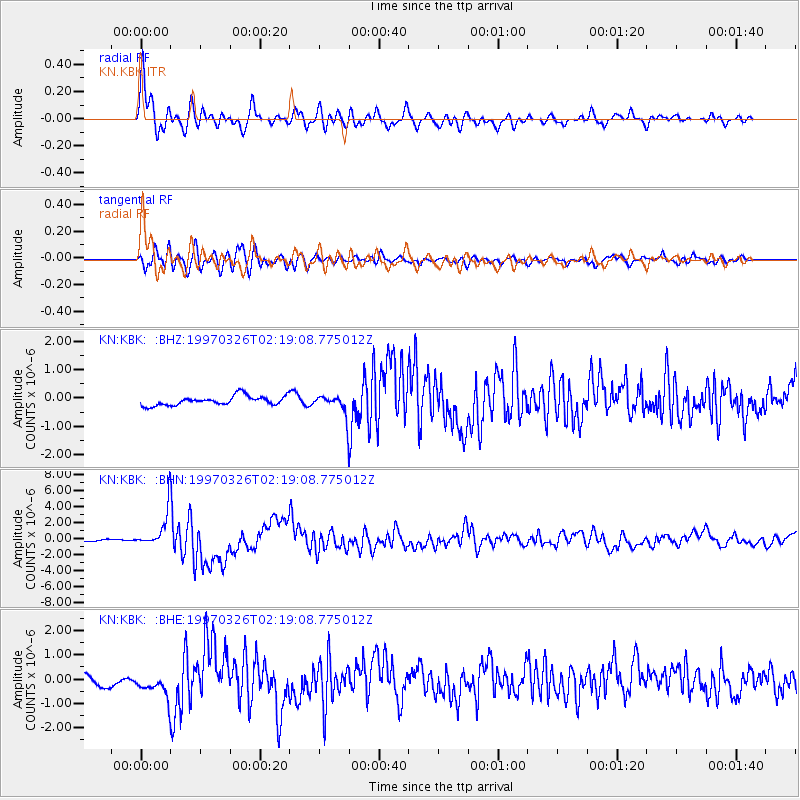
Earthquake location: Rat Islands, Aleutian Islands
Earthquake latitude/longitude: 51.3/179.5
Earthquake time(UTC): 1997/03/26 (085) 02:08:57 GMT
Earthquake Depth: 33 km
Earthquake Magnitude: 6.0 MB, 6.5 MS, 6.7 UNKNOWN, 6.3 ML
Earthquake Catalog/Contributor: WHDF/NEIC
Network: KN Kyrgyz Seismic Telemetry Network
Station: KBK KN.KBK
Lat/Lon: 42.66 N/74.95 E
Elevation: 1760 m
Distance: 65.9 deg
Az: 308.536 deg
Baz: 41.761 deg
Ray Param: 0.05792928
Estimated Moho Depth: 59.0 km
Estimated Crust Vp/Vs: 1.88
Assumed Crust Vp: 6.306 km/s
Estimated Crust Vs: 3.354 km/s
Estimated Crust Poisson's Ratio: 0.30
Radial Match: 92.41192 %
Radial Bump: 400
Transverse Match: 80.71886 %
Transverse Bump: 400
SOD ConfigId: 4480
Insert Time: 2010-03-08 20:00:50.653 +0000
GWidth: 2.5
Max Bumps: 400
Tol: 0.001

Signal To Noise

ChannelStoNSTALTA
KN:KBK: :BHN:19970326T02:19:08.775012Z16.4676822.2536374E-61.3685214E-7
KN:KBK: :BHE:19970326T02:19:08.775012Z2.71362165.539178E-72.0412492E-7
KN:KBK: :BHZ:19970326T02:19:08.775012Z2.30284573.752446E-71.6294821E-7
Arrivals
Ps8.5 SECOND
PpPs26 SECOND
PsPs/PpSs35 SECOND