
KBK KN.KBK - Earthquake Result Viewer
| ||||||||||||||||||
| ||||||||||||||||||
| ||||||||||||||||||
|
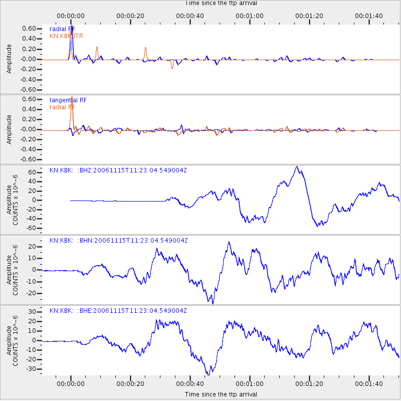
Signal To Noise
| Channel | StoN | STA | LTA |
| KN:KBK: :BHN:20061115T11:23:04.549004Z | 6.194649 | 1.1870588E-6 | 1.9162648E-7 |
| KN:KBK: :BHE:20061115T11:23:04.549004Z | 5.040013 | 1.461094E-6 | 2.8989888E-7 |
| KN:KBK: :BHZ:20061115T11:23:04.549004Z | 9.259149 | 3.6335075E-6 | 3.924235E-7 |
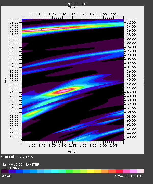
| Arrivals | |
| Ps | 1.8 SECOND |
| PpPs | 6.2 SECOND |
| PsPs/PpSs | 7.9 SECOND |

