You are here: Home > Network List > IU - Global Seismograph Network (GSN - IRIS/USGS) Stations List
> Station JOHN Johnston Island, USA > Earthquake Result Viewer
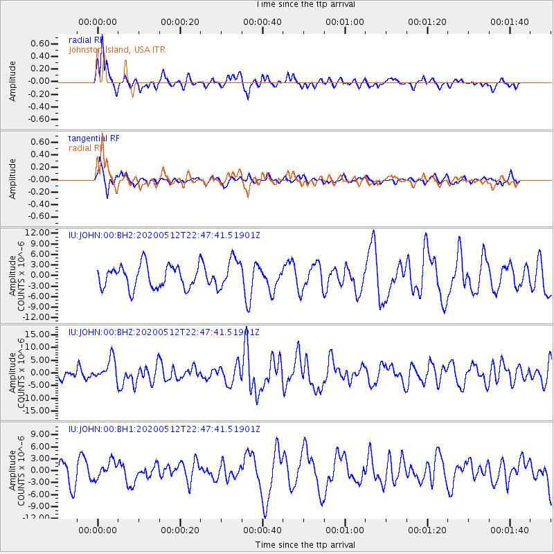
JOHN Johnston Island, USA - Earthquake Result Viewer
*The percent match for this event was below the threshold and hence no stack was calculated.
| Earthquake location: |
Santa Cruz Islands |
| Earthquake latitude/longitude: |
-12.1/166.6 |
| Earthquake time(UTC): |
2020/05/12 (133) 22:41:12 GMT |
| Earthquake Depth: |
107 km |
| Earthquake Magnitude: |
6.6 mww |
| Earthquake Catalog/Contributor: |
NEIC PDE/us |
|
| Network: |
IU Global Seismograph Network (GSN - IRIS/USGS) |
| Station: |
JOHN Johnston Island, USA |
| Lat/Lon: |
16.73 N/169.53 W |
| Elevation: |
2.0 m |
|
| Distance: |
37.1 deg |
| Az: |
39.955 deg |
| Baz: |
220.965 deg |
| Ray Param: |
$rayparam |
*The percent match for this event was below the threshold and hence was not used in the summary stack. |
|
| Radial Match: |
83.30468 % |
| Radial Bump: |
314 |
| Transverse Match: |
57.01244 % |
| Transverse Bump: |
338 |
| SOD ConfigId: |
21166931 |
| Insert Time: |
2020-05-26 22:54:40.660 +0000 |
| GWidth: |
2.5 |
| Max Bumps: |
400 |
| Tol: |
0.001 |
|
Signal To Noise
| Channel | StoN | STA | LTA |
| IU:JOHN:00:BHZ:20200512T22:47:41.51901Z | 2.3444543 | 4.437773E-6 | 1.892881E-6 |
| IU:JOHN:00:BH1:20200512T22:47:41.51901Z | 0.9148713 | 2.214617E-6 | 2.4206872E-6 |
| IU:JOHN:00:BH2:20200512T22:47:41.51901Z | 1.373704 | 4.376271E-6 | 3.1857453E-6 |
| Arrivals |
| Ps | |
| PpPs | |
| PsPs/PpSs | |


