You are here: Home > Network List > G - GEOSCOPE Stations List
> Station NOUC Port Laguerre, New Caledonia > Earthquake Result Viewer
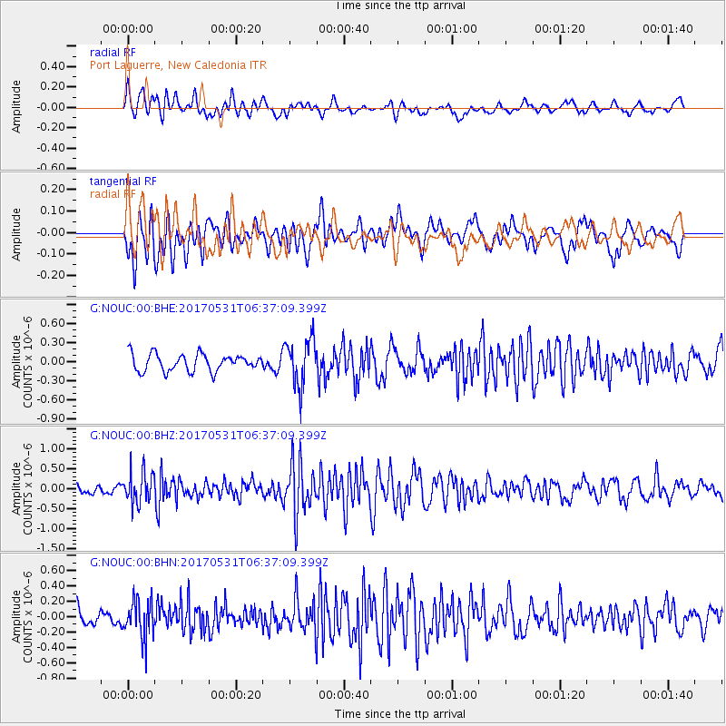
NOUC Port Laguerre, New Caledonia - Earthquake Result Viewer
*The percent match for this event was below the threshold and hence no stack was calculated.
| Earthquake location: |
Mariana Islands |
| Earthquake latitude/longitude: |
19.1/145.9 |
| Earthquake time(UTC): |
2017/05/31 (151) 06:29:32 GMT |
| Earthquake Depth: |
121 km |
| Earthquake Magnitude: |
5.4 Mww |
| Earthquake Catalog/Contributor: |
NEIC PDE/us |
|
| Network: |
G GEOSCOPE |
| Station: |
NOUC Port Laguerre, New Caledonia |
| Lat/Lon: |
22.10 S/166.30 E |
| Elevation: |
112 m |
|
| Distance: |
45.6 deg |
| Az: |
153.018 deg |
| Baz: |
332.442 deg |
| Ray Param: |
$rayparam |
*The percent match for this event was below the threshold and hence was not used in the summary stack. |
|
| Radial Match: |
66.00587 % |
| Radial Bump: |
400 |
| Transverse Match: |
53.96415 % |
| Transverse Bump: |
400 |
| SOD ConfigId: |
2140511 |
| Insert Time: |
2017-06-13 22:22:04.277 +0000 |
| GWidth: |
2.5 |
| Max Bumps: |
400 |
| Tol: |
0.001 |
|
Signal To Noise
| Channel | StoN | STA | LTA |
| G:NOUC:00:BHZ:20170531T06:37:09.399Z | 2.3773084 | 3.9829519E-7 | 1.6754038E-7 |
| G:NOUC:00:BHN:20170531T06:37:09.399Z | 2.4391673 | 2.4351044E-7 | 9.983344E-8 |
| G:NOUC:00:BHE:20170531T06:37:09.399Z | 2.8030562 | 3.7764852E-7 | 1.3472742E-7 |
| Arrivals |
| Ps | |
| PpPs | |
| PsPs/PpSs | |


