KBK KN.KBK - Earthquake Result Viewer
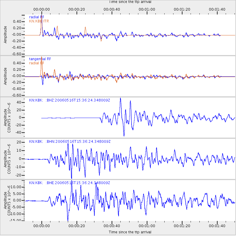
Earthquake location: Northern Sumatra, Indonesia
Earthquake latitude/longitude: 0.1/97.1
Earthquake time(UTC): 2006/05/16 (136) 15:28:25 GMT
Earthquake Depth: 12 km
Earthquake Magnitude: 6.6 MB, 6.8 MS, 6.8 MW, 6.8 MW
Earthquake Catalog/Contributor: WHDF/NEIC
Network: KN Kyrgyz Seismic Telemetry Network
Station: KBK KN.KBK
Lat/Lon: 42.66 N/74.95 E
Elevation: 1760 m
Distance: 46.8 deg
Az: 337.618 deg
Baz: 148.924 deg
Ray Param: 0.070410736
Estimated Moho Depth: 16.75 km
Estimated Crust Vp/Vs: 1.94
Assumed Crust Vp: 6.306 km/s
Estimated Crust Vs: 3.246 km/s
Estimated Crust Poisson's Ratio: 0.32
Radial Match: 94.59098 %
Radial Bump: 400
Transverse Match: 93.78284 %
Transverse Bump: 400
SOD ConfigId: 2669
Insert Time: 2010-03-08 20:02:15.937 +0000
GWidth: 2.5
Max Bumps: 400
Tol: 0.001

Signal To Noise

ChannelStoNSTALTA
KN:KBK: :BHN:20060516T15:36:24.348009Z16.3547251.4239707E-68.7067846E-8
KN:KBK: :BHE:20060516T15:36:24.348009Z9.516439.514726E-79.99821E-8
KN:KBK: :BHZ:20060516T15:36:24.348009Z46.3805473.7294537E-68.040987E-8
Arrivals
Ps2.6 SECOND
PpPs7.4 SECOND
PsPs/PpSs10 SECOND