KBK KN.KBK - Earthquake Result Viewer
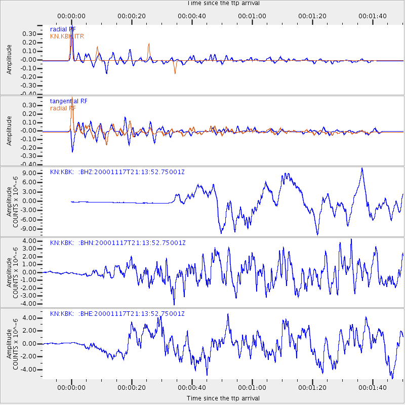
Earthquake location: New Britain Region, P.N.G.
Earthquake latitude/longitude: -5.5/151.8
Earthquake time(UTC): 2000/11/17 (322) 21:01:56 GMT
Earthquake Depth: 33 km
Earthquake Magnitude: 6.2 MB, 8.0 MS, 7.6 MW, 6.9 ME
Earthquake Catalog/Contributor: WHDF/NEIC
Network: KN Kyrgyz Seismic Telemetry Network
Station: KBK KN.KBK
Lat/Lon: 42.66 N/74.95 E
Elevation: 1760 m
Distance: 84.1 deg
Az: 313.768 deg
Baz: 102.972 deg
Ray Param: 0.04568704
Estimated Moho Depth: 23.0 km
Estimated Crust Vp/Vs: 1.64
Assumed Crust Vp: 6.306 km/s
Estimated Crust Vs: 3.839 km/s
Estimated Crust Poisson's Ratio: 0.21
Radial Match: 94.40569 %
Radial Bump: 400
Transverse Match: 82.79468 %
Transverse Bump: 400
SOD ConfigId: 3744
Insert Time: 2010-03-08 20:03:06.282 +0000
GWidth: 2.5
Max Bumps: 400
Tol: 0.001

Signal To Noise

ChannelStoNSTALTA
KN:KBK: :BHN:20001117T21:13:52.75001Z0.508606268.277248E-81.6274373E-7
KN:KBK: :BHE:20001117T21:13:52.75001Z1.64444912.596846E-71.5791588E-7
KN:KBK: :BHZ:20001117T21:13:52.75001Z5.5046757.214439E-71.310602E-7
Arrivals
Ps2.4 SECOND
PpPs9.4 SECOND
PsPs/PpSs12 SECOND