You are here: Home > Network List > UU - University of Utah Regional Network Stations List
> Station FORU South Mineral Mountains, UT, USA > Earthquake Result Viewer
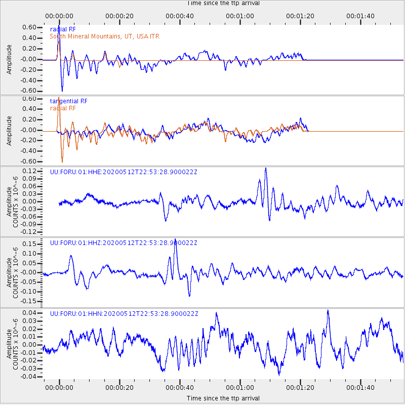
FORU South Mineral Mountains, UT, USA - Earthquake Result Viewer
*The percent match for this event was below the threshold and hence no stack was calculated.
| Earthquake location: |
Santa Cruz Islands |
| Earthquake latitude/longitude: |
-12.1/166.6 |
| Earthquake time(UTC): |
2020/05/12 (133) 22:41:12 GMT |
| Earthquake Depth: |
107 km |
| Earthquake Magnitude: |
6.6 mww |
| Earthquake Catalog/Contributor: |
NEIC PDE/us |
|
| Network: |
UU University of Utah Regional Network |
| Station: |
FORU South Mineral Mountains, UT, USA |
| Lat/Lon: |
38.46 N/112.86 W |
| Elevation: |
1840 m |
|
| Distance: |
90.1 deg |
| Az: |
50.741 deg |
| Baz: |
254.742 deg |
| Ray Param: |
$rayparam |
*The percent match for this event was below the threshold and hence was not used in the summary stack. |
|
| Radial Match: |
65.3138 % |
| Radial Bump: |
400 |
| Transverse Match: |
41.4351 % |
| Transverse Bump: |
400 |
| SOD ConfigId: |
21166931 |
| Insert Time: |
2020-05-26 23:04:02.977 +0000 |
| GWidth: |
2.5 |
| Max Bumps: |
400 |
| Tol: |
0.001 |
|
Signal To Noise
| Channel | StoN | STA | LTA |
| UU:FORU:01:HHZ:20200512T22:53:28.900022Z | 8.321608 | 3.894462E-8 | 4.6799395E-9 |
| UU:FORU:01:HHN:20200512T22:53:28.900022Z | 1.1665845 | 1.6681259E-8 | 1.4299229E-8 |
| UU:FORU:01:HHE:20200512T22:53:28.900022Z | 1.07541 | 1.2616668E-8 | 1.173196E-8 |
| Arrivals |
| Ps | |
| PpPs | |
| PsPs/PpSs | |


