You are here: Home > Network List > UW - Pacific Northwest Regional Seismic Network Stations List
> Station FISH Seaside, OR, USA > Earthquake Result Viewer
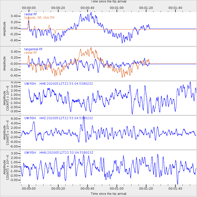
FISH Seaside, OR, USA - Earthquake Result Viewer
*The percent match for this event was below the threshold and hence no stack was calculated.
| Earthquake location: |
Santa Cruz Islands |
| Earthquake latitude/longitude: |
-12.1/166.6 |
| Earthquake time(UTC): |
2020/05/12 (133) 22:41:12 GMT |
| Earthquake Depth: |
107 km |
| Earthquake Magnitude: |
6.6 mww |
| Earthquake Catalog/Contributor: |
NEIC PDE/us |
|
| Network: |
UW Pacific Northwest Regional Seismic Network |
| Station: |
FISH Seaside, OR, USA |
| Lat/Lon: |
45.93 N/123.56 W |
| Elevation: |
325 m |
|
| Distance: |
85.0 deg |
| Az: |
41.108 deg |
| Baz: |
247.144 deg |
| Ray Param: |
$rayparam |
*The percent match for this event was below the threshold and hence was not used in the summary stack. |
|
| Radial Match: |
66.005196 % |
| Radial Bump: |
400 |
| Transverse Match: |
47.28065 % |
| Transverse Bump: |
353 |
| SOD ConfigId: |
21166931 |
| Insert Time: |
2020-05-26 23:04:56.900 +0000 |
| GWidth: |
2.5 |
| Max Bumps: |
400 |
| Tol: |
0.001 |
|
Signal To Noise
| Channel | StoN | STA | LTA |
| UW:FISH: :HHZ:20200512T22:53:04.538023Z | 3.5183623 | 2.2636375E-6 | 6.433782E-7 |
| UW:FISH: :HHN:20200512T22:53:04.538023Z | 0.61332536 | 7.1064926E-7 | 1.1586824E-6 |
| UW:FISH: :HHE:20200512T22:53:04.538023Z | 1.4146346 | 1.3960582E-6 | 9.868684E-7 |
| Arrivals |
| Ps | |
| PpPs | |
| PsPs/PpSs | |


