
KBK KN.KBK - Earthquake Result Viewer
| ||||||||||||||||||
| ||||||||||||||||||
| ||||||||||||||||||
|
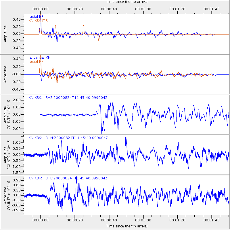
Signal To Noise
| Channel | StoN | STA | LTA |
| KN:KBK: :BHN:20000824T11:45:40.099004Z | 3.0234115 | 1.9218295E-7 | 6.356493E-8 |
| KN:KBK: :BHE:20000824T11:45:40.099004Z | 2.095545 | 1.3631083E-7 | 6.5047914E-8 |
| KN:KBK: :BHZ:20000824T11:45:40.099004Z | 10.177758 | 5.338249E-7 | 5.2450147E-8 |
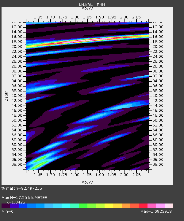
| Arrivals | |
| Ps | 2.4 SECOND |
| PpPs | 7.4 SECOND |
| PsPs/PpSs | 9.8 SECOND |

