KBK KN.KBK - Earthquake Result Viewer
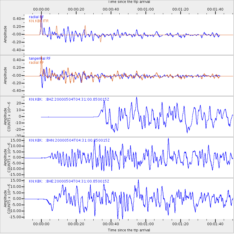
Earthquake location: Sulawesi, Indonesia
Earthquake latitude/longitude: -1.1/123.6
Earthquake time(UTC): 2000/05/04 (125) 04:21:16 GMT
Earthquake Depth: 26 km
Earthquake Magnitude: 6.7 MB, 7.5 MS, 7.6 MW, 7.5 ME
Earthquake Catalog/Contributor: WHDF/NEIC
Network: KN Kyrgyz Seismic Telemetry Network
Station: KBK KN.KBK
Lat/Lon: 42.66 N/74.95 E
Elevation: 1760 m
Distance: 61.7 deg
Az: 321.031 deg
Baz: 121.53 deg
Ray Param: 0.06069106
Estimated Moho Depth: 11.75 km
Estimated Crust Vp/Vs: 1.60
Assumed Crust Vp: 6.306 km/s
Estimated Crust Vs: 3.941 km/s
Estimated Crust Poisson's Ratio: 0.18
Radial Match: 92.50148 %
Radial Bump: 400
Transverse Match: 91.84683 %
Transverse Bump: 400
SOD ConfigId: 3744
Insert Time: 2010-03-08 20:04:37.970 +0000
GWidth: 2.5
Max Bumps: 400
Tol: 0.001

Signal To Noise

ChannelStoNSTALTA
KN:KBK: :BHN:20000504T04:31:00.850015Z7.76487164.47051E-75.757352E-8
KN:KBK: :BHE:20000504T04:31:00.850015Z26.3896921.4611613E-65.5368634E-8
KN:KBK: :BHZ:20000504T04:31:00.850015Z65.3757864.333697E-66.628902E-8
Arrivals
Ps1.2 SECOND
PpPs4.6 SECOND
PsPs/PpSs5.8 SECOND