You are here: Home > Network List > KN - Kyrgyz Seismic Telemetry Network Stations List
> Station KBK KN.KBK > Earthquake Result Viewer
KBK KN.KBK - Earthquake Result Viewer

| Earthquake location: |
Western Honshu, Japan |
| Earthquake latitude/longitude: |
34.1/132.5 |
| Earthquake time(UTC): |
2001/03/24 (083) 06:27:53 GMT |
| Earthquake Depth: |
50 km |
| Earthquake Magnitude: |
6.4 MB, 6.5 MS, 6.8 MW, 6.4 ME |
| Earthquake Catalog/Contributor: |
WHDF/NEIC |
|
| Network: |
KN Kyrgyz Seismic Telemetry Network |
| Station: |
KBK KN.KBK |
| Lat/Lon: |
42.66 N/74.95 E |
| Elevation: |
1760 m |
|
| Distance: |
45.2 deg |
| Az: |
298.615 deg |
| Baz: |
80.992 deg |
| Ray Param: |
0.07130983 |
| Estimated Moho Depth: |
49.25 km |
| Estimated Crust Vp/Vs: |
2.08 |
| Assumed Crust Vp: |
6.306 km/s |
| Estimated Crust Vs: |
3.028 km/s |
| Estimated Crust Poisson's Ratio: |
0.35 |
|
| Radial Match: |
93.70729 % |
| Radial Bump: |
400 |
| Transverse Match: |
82.30334 % |
| Transverse Bump: |
400 |
| SOD ConfigId: |
4714 |
| Insert Time: |
2010-03-08 20:05:33.656 +0000 |
| GWidth: |
2.5 |
| Max Bumps: |
400 |
| Tol: |
0.001 |
|
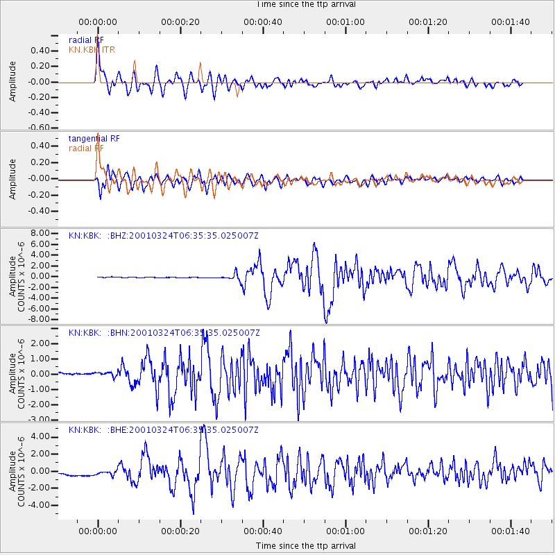
Signal To Noise
| Channel | StoN | STA | LTA |
| KN:KBK: :BHN:20010324T06:35:35.025007Z | 1.1887119 | 1.7209136E-7 | 1.4477129E-7 |
| KN:KBK: :BHE:20010324T06:35:35.025007Z | 1.1870081 | 2.7035068E-7 | 2.2775806E-7 |
| KN:KBK: :BHZ:20010324T06:35:35.025007Z | 11.708114 | 6.622684E-7 | 5.656491E-8 |
| Arrivals |
| Ps | 8.9 SECOND |
| PpPs | 23 SECOND |
| PsPs/PpSs | 32 SECOND |


