KBK KN.KBK - Earthquake Result Viewer
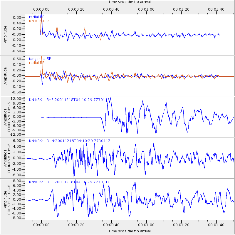
Earthquake location: Taiwan Region
Earthquake latitude/longitude: 24.0/122.7
Earthquake time(UTC): 2001/12/18 (352) 04:02:58 GMT
Earthquake Depth: 14 km
Earthquake Magnitude: 6.3 MB, 7.3 MS, 6.9 MW, 6.8 MW
Earthquake Catalog/Contributor: WHDF/NEIC
Network: KN Kyrgyz Seismic Telemetry Network
Station: KBK KN.KBK
Lat/Lon: 42.66 N/74.95 E
Elevation: 1760 m
Distance: 43.4 deg
Az: 307.389 deg
Baz: 99.811 deg
Ray Param: 0.07253736
Estimated Moho Depth: 32.75 km
Estimated Crust Vp/Vs: 1.85
Assumed Crust Vp: 6.306 km/s
Estimated Crust Vs: 3.413 km/s
Estimated Crust Poisson's Ratio: 0.29
Radial Match: 95.76012 %
Radial Bump: 400
Transverse Match: 91.66543 %
Transverse Bump: 400
SOD ConfigId: 20082
Insert Time: 2010-03-08 20:05:45.671 +0000
GWidth: 2.5
Max Bumps: 400
Tol: 0.001

Signal To Noise

ChannelStoNSTALTA
KN:KBK: :BHN:20011218T04:10:29.773011Z1.76112992.729302E-71.549745E-7
KN:KBK: :BHE:20011218T04:10:29.773011Z1.73807182.9466037E-71.695329E-7
KN:KBK: :BHZ:20011218T04:10:29.773011Z5.9859845.957492E-79.952403E-8
Arrivals
Ps4.7 SECOND
PpPs14 SECOND
PsPs/PpSs19 SECOND