KBK KN.KBK - Earthquake Result Viewer
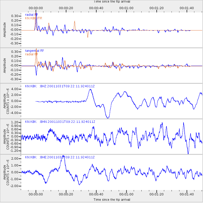
Earthquake location: New Britain Region, P.N.G.
Earthquake latitude/longitude: -5.9/150.2
Earthquake time(UTC): 2001/10/31 (304) 09:10:20 GMT
Earthquake Depth: 33 km
Earthquake Magnitude: 5.9 MB, 6.9 MS, 6.9 MW, 6.9 MW
Earthquake Catalog/Contributor: WHDF/NEIC
Network: KN Kyrgyz Seismic Telemetry Network
Station: KBK KN.KBK
Lat/Lon: 42.66 N/74.95 E
Elevation: 1760 m
Distance: 83.2 deg
Az: 314.079 deg
Baz: 104.372 deg
Ray Param: 0.04628775
Estimated Moho Depth: 13.5 km
Estimated Crust Vp/Vs: 1.84
Assumed Crust Vp: 6.306 km/s
Estimated Crust Vs: 3.427 km/s
Estimated Crust Poisson's Ratio: 0.29
Radial Match: 95.069374 %
Radial Bump: 400
Transverse Match: 83.56471 %
Transverse Bump: 400
SOD ConfigId: 20082
Insert Time: 2010-03-08 20:05:51.716 +0000
GWidth: 2.5
Max Bumps: 400
Tol: 0.001

Signal To Noise

ChannelStoNSTALTA
KN:KBK: :BHN:20011031T09:22:11.924011Z1.52711652.0092027E-71.315684E-7
KN:KBK: :BHE:20011031T09:22:11.924011Z2.72985532.625354E-79.617191E-8
KN:KBK: :BHZ:20011031T09:22:11.924011Z7.4050968.0317653E-71.0846268E-7
Arrivals
Ps1.8 SECOND
PpPs5.9 SECOND
PsPs/PpSs7.8 SECOND