
KBK KN.KBK - Earthquake Result Viewer

| ||||||||||||||||||
| ||||||||||||||||||
| ||||||||||||||||||
|
Signal To Noise
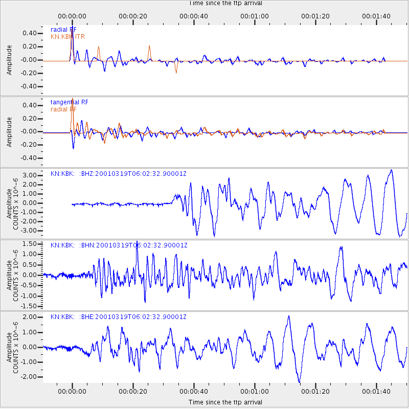
| Channel | StoN | STA | LTA |
| KN:KBK: :BHN:20010319T06:02:32.90001Z | 1.0460322 | 6.805497E-8 | 6.5060114E-8 |
| KN:KBK: :BHE:20010319T06:02:32.90001Z | 2.4354687 | 1.7106014E-7 | 7.023705E-8 |
| KN:KBK: :BHZ:20010319T06:02:32.90001Z | 5.7572956 | 4.2424267E-7 | 7.368784E-8 |
| Arrivals | |
| Ps | 4.9 SECOND |
| PpPs | 13 SECOND |
| PsPs/PpSs | 18 SECOND |

