You are here: Home > Network List > WY - Yellowstone Wyoming Seismic Network Stations List
> Station YHR Hawk's Rest, WY, USA > Earthquake Result Viewer
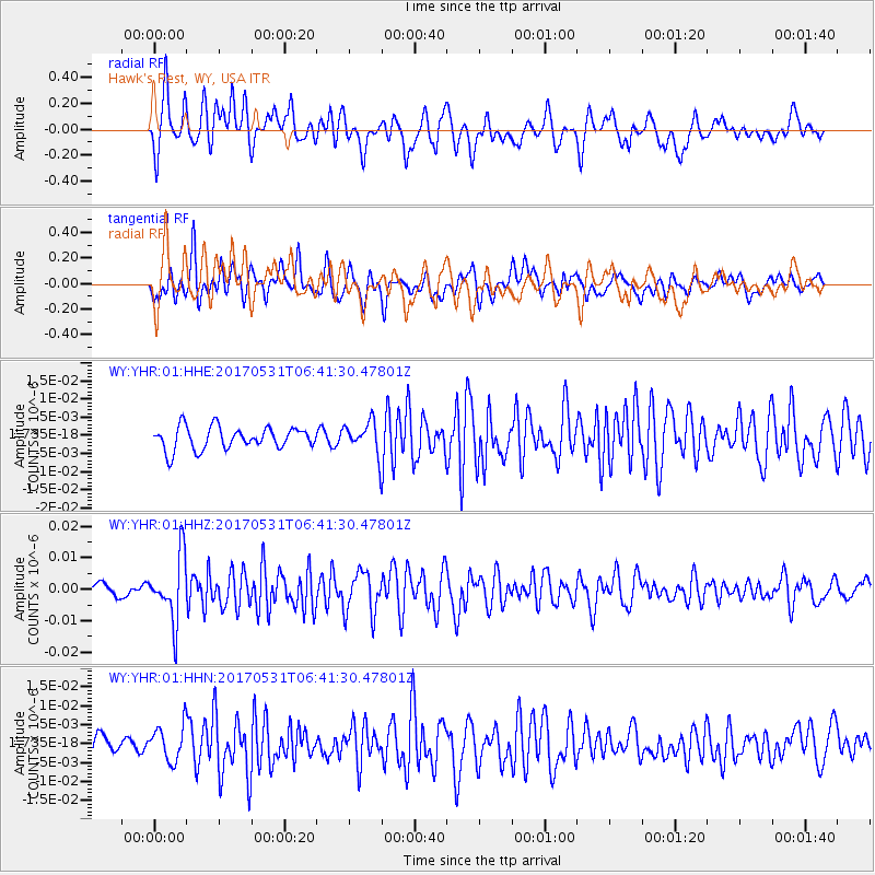
YHR Hawk's Rest, WY, USA - Earthquake Result Viewer
*The percent match for this event was below the threshold and hence no stack was calculated.
| Earthquake location: |
Mariana Islands |
| Earthquake latitude/longitude: |
19.1/145.9 |
| Earthquake time(UTC): |
2017/05/31 (151) 06:29:32 GMT |
| Earthquake Depth: |
121 km |
| Earthquake Magnitude: |
5.4 Mww |
| Earthquake Catalog/Contributor: |
NEIC PDE/us |
|
| Network: |
WY Yellowstone Wyoming Seismic Network |
| Station: |
YHR Hawk's Rest, WY, USA |
| Lat/Lon: |
44.11 N/110.08 W |
| Elevation: |
2976 m |
|
| Distance: |
86.6 deg |
| Az: |
44.432 deg |
| Baz: |
293.225 deg |
| Ray Param: |
$rayparam |
*The percent match for this event was below the threshold and hence was not used in the summary stack. |
|
| Radial Match: |
79.0738 % |
| Radial Bump: |
400 |
| Transverse Match: |
66.84113 % |
| Transverse Bump: |
400 |
| SOD ConfigId: |
2140511 |
| Insert Time: |
2017-06-13 22:26:13.662 +0000 |
| GWidth: |
2.5 |
| Max Bumps: |
400 |
| Tol: |
0.001 |
|
Signal To Noise
| Channel | StoN | STA | LTA |
| WY:YHR:01:HHZ:20170531T06:41:30.47801Z | 4.5149035 | 1.0243304E-8 | 2.2687758E-9 |
| WY:YHR:01:HHN:20170531T06:41:30.47801Z | 1.7584481 | 4.6899227E-9 | 2.6670803E-9 |
| WY:YHR:01:HHE:20170531T06:41:30.47801Z | 1.436428 | 4.418436E-9 | 3.0759884E-9 |
| Arrivals |
| Ps | |
| PpPs | |
| PsPs/PpSs | |


