
KBK KN.KBK - Earthquake Result Viewer
| ||||||||||||||||||
| ||||||||||||||||||
| ||||||||||||||||||
|
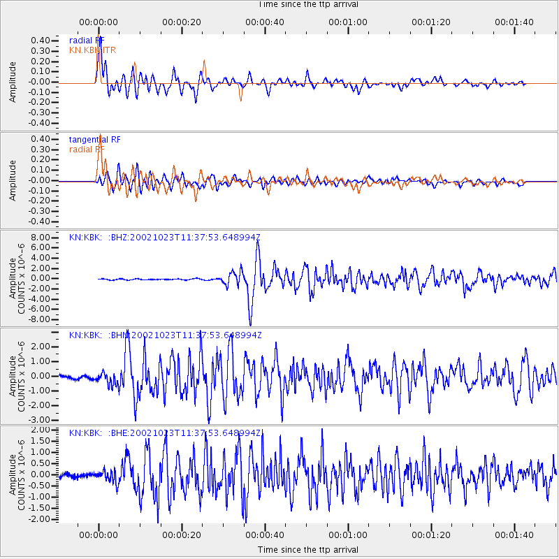
Signal To Noise
| Channel | StoN | STA | LTA |
| KN:KBK: :BHN:20021023T11:37:53.648994Z | 2.9928918 | 4.861339E-7 | 1.624295E-7 |
| KN:KBK: :BHE:20021023T11:37:53.648994Z | 2.7624753 | 2.5795978E-7 | 9.337994E-8 |
| KN:KBK: :BHZ:20021023T11:37:53.648994Z | 12.669152 | 1.2712038E-6 | 1.00338504E-7 |
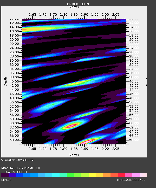
| Arrivals | |
| Ps | 10 SECOND |
| PpPs | 31 SECOND |
| PsPs/PpSs | 41 SECOND |

