You are here: Home > Network List > TA - USArray Transportable Network (new EarthScope stations) Stations List
> Station C16K Lisburne Hills, AK, USA > Earthquake Result Viewer
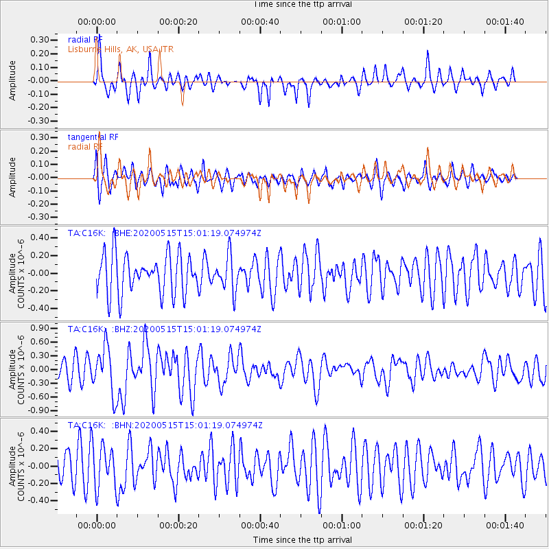
C16K Lisburne Hills, AK, USA - Earthquake Result Viewer
*The percent match for this event was below the threshold and hence no stack was calculated.
| Earthquake location: |
Samoa Islands Region |
| Earthquake latitude/longitude: |
-15.6/-173.0 |
| Earthquake time(UTC): |
2020/05/15 (136) 14:49:21 GMT |
| Earthquake Depth: |
16 km |
| Earthquake Magnitude: |
5.8 mww |
| Earthquake Catalog/Contributor: |
NEIC PDE/us |
|
| Network: |
TA USArray Transportable Network (new EarthScope stations) |
| Station: |
C16K Lisburne Hills, AK, USA |
| Lat/Lon: |
68.27 N/165.34 W |
| Elevation: |
102 m |
|
| Distance: |
83.8 deg |
| Az: |
2.85 deg |
| Baz: |
187.393 deg |
| Ray Param: |
$rayparam |
*The percent match for this event was below the threshold and hence was not used in the summary stack. |
|
| Radial Match: |
67.48459 % |
| Radial Bump: |
400 |
| Transverse Match: |
55.58449 % |
| Transverse Bump: |
400 |
| SOD ConfigId: |
21166931 |
| Insert Time: |
2020-05-29 15:05:56.645 +0000 |
| GWidth: |
2.5 |
| Max Bumps: |
400 |
| Tol: |
0.001 |
|
Signal To Noise
| Channel | StoN | STA | LTA |
| TA:C16K: :BHZ:20200515T15:01:19.074974Z | 2.6780365 | 5.283783E-7 | 1.9730064E-7 |
| TA:C16K: :BHN:20200515T15:01:19.074974Z | 1.2228819 | 2.3572323E-7 | 1.9276041E-7 |
| TA:C16K: :BHE:20200515T15:01:19.074974Z | 0.9247203 | 2.0590757E-7 | 2.2267011E-7 |
| Arrivals |
| Ps | |
| PpPs | |
| PsPs/PpSs | |


