KBK KN.KBK - Earthquake Result Viewer
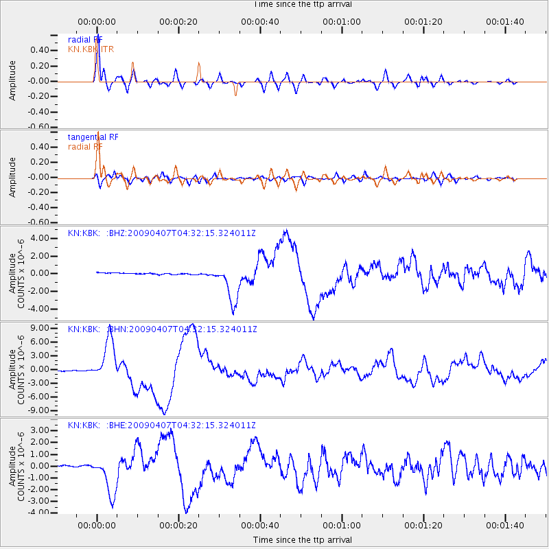
Earthquake location: Kuril Islands
Earthquake latitude/longitude: 46.0/151.5
Earthquake time(UTC): 2009/04/07 (097) 04:23:33 GMT
Earthquake Depth: 31 km
Earthquake Magnitude: 6.5 MB, 6.8 MS, 6.9 MW, 6.9 MW
Earthquake Catalog/Contributor: WHDF/NEIC
Network: KN Kyrgyz Seismic Telemetry Network
Station: KBK KN.KBK
Lat/Lon: 42.66 N/74.95 E
Elevation: 1760 m
Distance: 52.9 deg
Az: 295.84 deg
Baz: 58.179 deg
Ray Param: 0.06641946
Estimated Moho Depth: 14.25 km
Estimated Crust Vp/Vs: 1.74
Assumed Crust Vp: 6.306 km/s
Estimated Crust Vs: 3.619 km/s
Estimated Crust Poisson's Ratio: 0.25
Radial Match: 96.6482 %
Radial Bump: 400
Transverse Match: 80.08316 %
Transverse Bump: 400
SOD ConfigId: 2658
Insert Time: 2010-03-08 20:08:11.704 +0000
GWidth: 2.5
Max Bumps: 400
Tol: 0.001

Signal To Noise

ChannelStoNSTALTA
KN:KBK: :BHN:20090407T04:32:15.324011Z103.434814.8380407E-64.6773813E-8
KN:KBK: :BHE:20090407T04:32:15.324011Z10.6889791.6310784E-61.525944E-7
KN:KBK: :BHZ:20090407T04:32:15.324011Z29.6494372.2973916E-67.748517E-8
Arrivals
Ps1.8 SECOND
PpPs5.9 SECOND
PsPs/PpSs7.6 SECOND