You are here: Home > Network List > TA - USArray Transportable Network (new EarthScope stations) Stations List
> Station G31M Satah River, YT, CAN > Earthquake Result Viewer
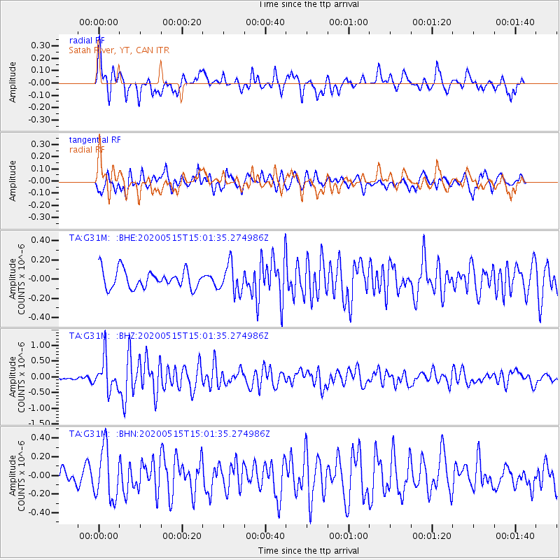
G31M Satah River, YT, CAN - Earthquake Result Viewer
*The percent match for this event was below the threshold and hence no stack was calculated.
| Earthquake location: |
Samoa Islands Region |
| Earthquake latitude/longitude: |
-15.6/-173.0 |
| Earthquake time(UTC): |
2020/05/15 (136) 14:49:21 GMT |
| Earthquake Depth: |
16 km |
| Earthquake Magnitude: |
5.8 mww |
| Earthquake Catalog/Contributor: |
NEIC PDE/us |
|
| Network: |
TA USArray Transportable Network (new EarthScope stations) |
| Station: |
G31M Satah River, YT, CAN |
| Lat/Lon: |
66.92 N/134.27 W |
| Elevation: |
61 m |
|
| Distance: |
87.1 deg |
| Az: |
14.288 deg |
| Baz: |
217.105 deg |
| Ray Param: |
$rayparam |
*The percent match for this event was below the threshold and hence was not used in the summary stack. |
|
| Radial Match: |
67.052895 % |
| Radial Bump: |
367 |
| Transverse Match: |
71.75154 % |
| Transverse Bump: |
400 |
| SOD ConfigId: |
21166931 |
| Insert Time: |
2020-05-29 15:07:10.608 +0000 |
| GWidth: |
2.5 |
| Max Bumps: |
400 |
| Tol: |
0.001 |
|
Signal To Noise
| Channel | StoN | STA | LTA |
| TA:G31M: :BHZ:20200515T15:01:35.274986Z | 5.259825 | 5.1314225E-7 | 9.75588E-8 |
| TA:G31M: :BHN:20200515T15:01:35.274986Z | 2.3925197 | 2.7905156E-7 | 1.16635015E-7 |
| TA:G31M: :BHE:20200515T15:01:35.274986Z | 1.5743332 | 1.4765304E-7 | 9.378767E-8 |
| Arrivals |
| Ps | |
| PpPs | |
| PsPs/PpSs | |


