You are here: Home > Network List > TA - USArray Transportable Network (new EarthScope stations) Stations List
> Station H31M Peel River, Yukon, CAN > Earthquake Result Viewer
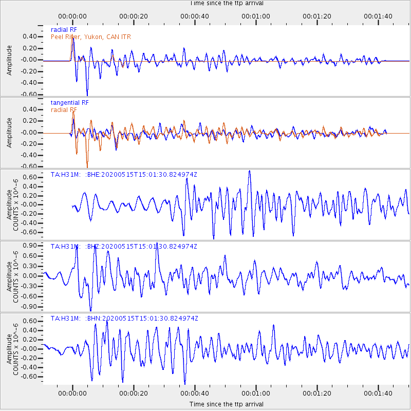
H31M Peel River, Yukon, CAN - Earthquake Result Viewer
*The percent match for this event was below the threshold and hence no stack was calculated.
| Earthquake location: |
Samoa Islands Region |
| Earthquake latitude/longitude: |
-15.6/-173.0 |
| Earthquake time(UTC): |
2020/05/15 (136) 14:49:21 GMT |
| Earthquake Depth: |
16 km |
| Earthquake Magnitude: |
5.8 mww |
| Earthquake Catalog/Contributor: |
NEIC PDE/us |
|
| Network: |
TA USArray Transportable Network (new EarthScope stations) |
| Station: |
H31M Peel River, Yukon, CAN |
| Lat/Lon: |
65.81 N/134.34 W |
| Elevation: |
642 m |
|
| Distance: |
86.2 deg |
| Az: |
14.944 deg |
| Baz: |
217.077 deg |
| Ray Param: |
$rayparam |
*The percent match for this event was below the threshold and hence was not used in the summary stack. |
|
| Radial Match: |
80.248764 % |
| Radial Bump: |
400 |
| Transverse Match: |
66.09036 % |
| Transverse Bump: |
400 |
| SOD ConfigId: |
21166931 |
| Insert Time: |
2020-05-29 15:07:21.723 +0000 |
| GWidth: |
2.5 |
| Max Bumps: |
400 |
| Tol: |
0.001 |
|
Signal To Noise
| Channel | StoN | STA | LTA |
| TA:H31M: :BHZ:20200515T15:01:30.824974Z | 4.799028 | 4.2632624E-7 | 8.883596E-8 |
| TA:H31M: :BHN:20200515T15:01:30.824974Z | 0.9201106 | 8.832388E-8 | 9.5992675E-8 |
| TA:H31M: :BHE:20200515T15:01:30.824974Z | 1.2555209 | 1.5176873E-7 | 1.2088108E-7 |
| Arrivals |
| Ps | |
| PpPs | |
| PsPs/PpSs | |


