KBK KN.KBK - Earthquake Result Viewer
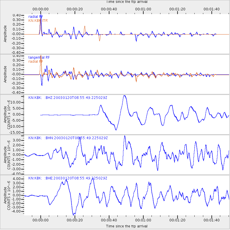
Earthquake location: Solomon Islands
Earthquake latitude/longitude: -10.5/160.8
Earthquake time(UTC): 2003/01/20 (020) 08:43:06 GMT
Earthquake Depth: 33 km
Earthquake Magnitude: 6.7 MB, 7.8 MS, 7.3 MW, 7.2 MW
Earthquake Catalog/Contributor: WHDF/NEIC
Network: KN Kyrgyz Seismic Telemetry Network
Station: KBK KN.KBK
Lat/Lon: 42.66 N/74.95 E
Elevation: 1760 m
Distance: 94.0 deg
Az: 312.481 deg
Baz: 100.502 deg
Ray Param: 0.04113914
Estimated Moho Depth: 47.25 km
Estimated Crust Vp/Vs: 1.66
Assumed Crust Vp: 6.306 km/s
Estimated Crust Vs: 3.799 km/s
Estimated Crust Poisson's Ratio: 0.22
Radial Match: 94.37321 %
Radial Bump: 400
Transverse Match: 92.17956 %
Transverse Bump: 400
SOD ConfigId: 4714
Insert Time: 2010-03-08 20:08:31.699 +0000
GWidth: 2.5
Max Bumps: 400
Tol: 0.001

Signal To Noise

ChannelStoNSTALTA
KN:KBK: :BHN:20030120T08:55:49.225029Z1.06967353.2578222E-73.045623E-7
KN:KBK: :BHE:20030120T08:55:49.225029Z4.1523863.801171E-79.154185E-8
KN:KBK: :BHZ:20030120T08:55:49.225029Z20.8352342.039048E-69.786538E-8
Arrivals
Ps5.0 SECOND
PpPs20 SECOND
PsPs/PpSs25 SECOND